Eta Precip Forecast - 06-12Z
Slide 39 of 52
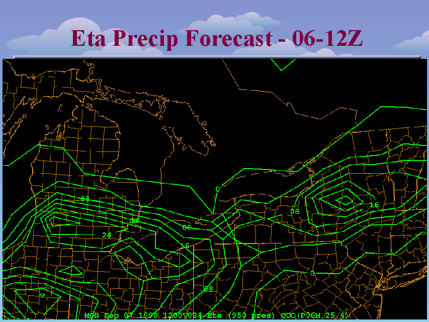
This slide shows the 6-hour Eta accumulated precipitation forecast for 06-12Z September 7th (a 24-hour forecast). The total 12-hour rainfall forecast by the Eta across the New York State Thruway corridor (the approximate track of the derecho) was roughly between a tenth (0.10) and a third (0.33) of an inch. These precipitation maps were generated from gridded data with an 80 km horizontal resolution. It is possible that graphics generated from precipitation grids using the Eta's native 32 km grid might have yielded higher forecast rainfall totals. However, because of bandwidth and processing limitations, these 80-km resolution grids with 6-hour temporal resolution are the data sets available to operational forecasters at the time of this event. While these Eta forecasts certainly point to the likelihood of showers and thunderstorms overnight accompanying the passage of the cold front, there does not appear to be an indication of the development of an intense squall line.


