| Created with the Web Accessibility Wizard |
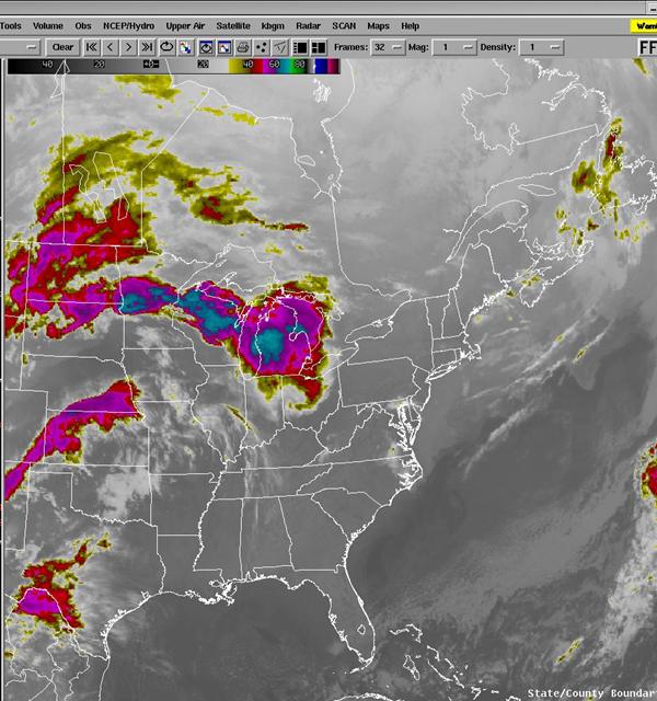
IR Satellite 4/18 09 UTC.
Slide Links:
Speaker Notes:
Satellite imagery at 09 UTC on the 18th indicated that thunderstorms were occurring along the north side of the upper ridge from Minnesota to southern Michigan (a "ring of fire" pattern, where thunderstorms develop around the periphery of an upper ridge).