| Created with the Web Accessibility Wizard |
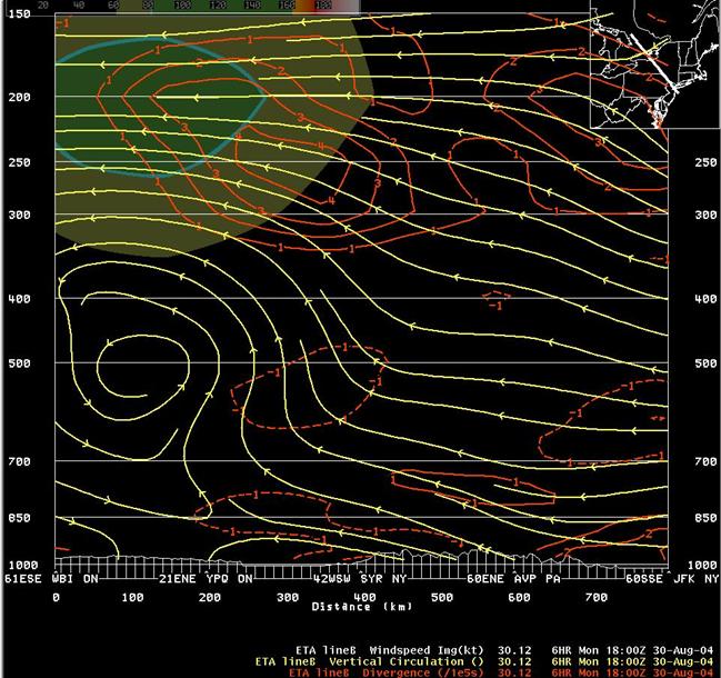
6-hr Eta forecast vertical circulation, divergence and wind speed (shaded) valid 18 UTC August 30st.
Slide Links:
Speaker Notes:
The data on this slide clearly shows the strong upper level divergence associated with the right entrance region of the upper-level wind maximum over Canada. An area of low-level convergence beneath the upper-level divergence is associated with the low-level front. A deep area of lift is shown from the low-level front up to the upper-level right entrance region. The upward branch of the circulation shown on this slide originates along the mid-Atlantic coast, in an area of rich moisture.