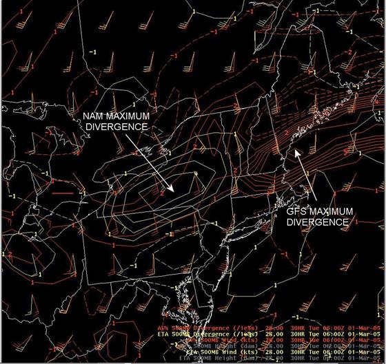
NAM and GFS 500 mb wind and divergence valid 1/06 UTC.
| Created with the Web Accessibility Wizard |
|
NAM and GFS 500 mb wind and divergence valid 1/06 UTC. |
|
|
Slide Links:
Speaker Notes:
This slide shows the difference between the 500 mb winds and associated divergence forecast by the NAM and GFS models valid at 01/06 UTC. The NAM forecasts (in yellow) show a strong maxima of divergence over central New York, associated with southeasterly flow at 500 mb. The GFS forecasts (in red) show the maxima of divergence over eastern New England, and more of a southerly flow over central New York at 500 mb.