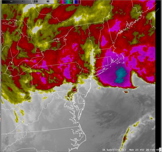
IR satellite image at 01/03 00 UTC.
| Created with the Web Accessibility Wizard |
|
IR satellite image at 01/03 00 UTC. |
|
|
Slide Links:
Speaker Notes:
The IR satellite data on this slide shows an area of convection developing well to the southeast of Long Island at 01/00 UTC. The surface low was deepening in that area at that time, well to the east of the NAM forecast position, close to the GFS position.