|
Switch images by moving your mouse pointer over the links below...
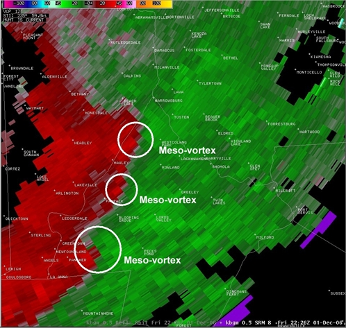
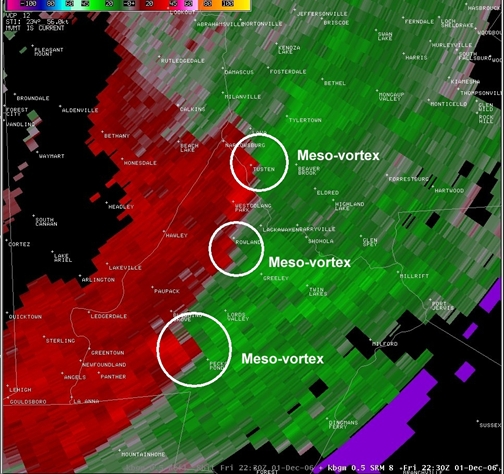
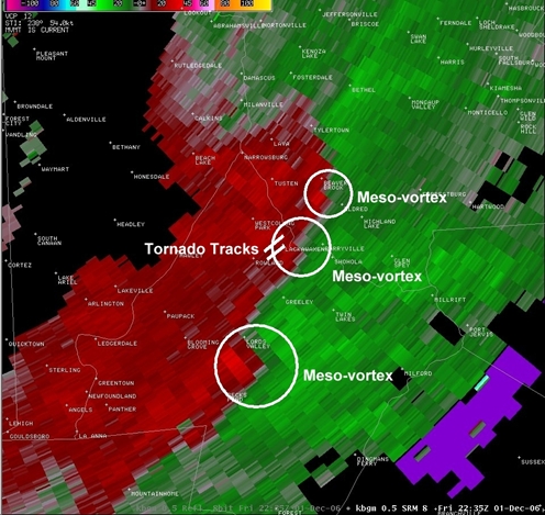
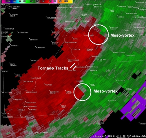
Fri 2226 UTC (5:26 PM EST) 01-Dec-2006 Fri 2230 UTC (5:30 PM EST) 01-Dec-2006 Fri 2235 UTC (5:35 PM EST) 01-Dec-2006 Fri 2239 UTC (5:39 PM EST) 01-Dec-2006 |
|
| Created with the Web Accessibility Wizard |
| Storm relative velocity – 2226 UTC – 2239 UTC |
|
Switch images by moving your mouse pointer over the links below...
Fri 2226 UTC (5:26 PM EST) 01-Dec-2006 Fri 2230 UTC (5:30 PM EST) 01-Dec-2006 Fri 2235 UTC (5:35 PM EST) 01-Dec-2006 Fri 2239 UTC (5:39 PM EST) 01-Dec-2006 |
|
Slide Links:
Speaker Notes:
Storm relative velocity at the time of these two brief touchdowns indicated that 3 meso-vortices were tracking northeast across Pike county. The tornadoes appeared to occur with the middle vortex. The middle vortex appeared to be the weakest of the three (at the elevation for which the radar was sampling, around 7000 feet above ground level). The meso-vortex also appeared to dissipate shortly after the tornadoes occurred.