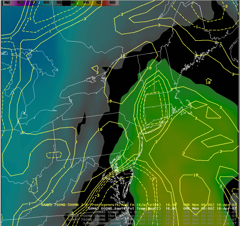
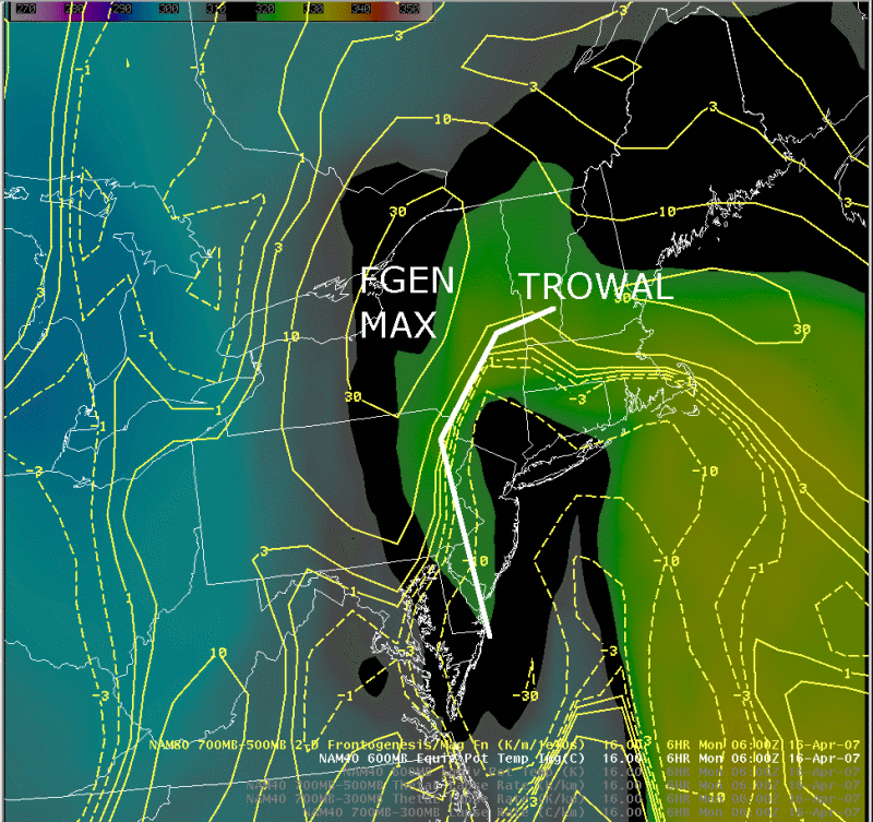
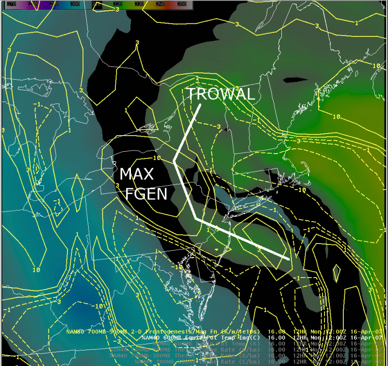
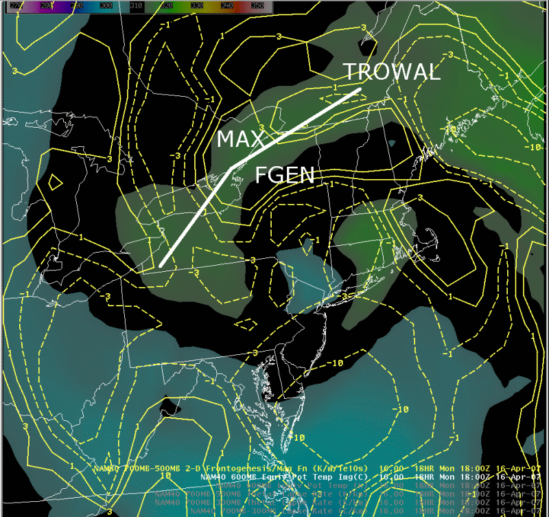
Equivalent potential temperature (600 mb) and 700-500 mb frontogenesis
Notes:
This loop shows model forecasts of equivalent potential temperature (shaded) at 600 mb and 700-500 mb frontogenesis, on April 16th. The TROWAL appears as a tongue of high equivalent potential temperature, wrapping around the northwest side of the cyclone over central NY and eastern Pa. The maximum of mid-level frontogenesis appears to initially develop on the northwest edge of the TROWAL, then shifts directly over the TRWOAL by 18 UTC.|
Switch images by moving your mouse pointer over the links below...
Mon 0000 UTC 16-Apr-2007 Mon 0600 UTC 16-Apr-2007 Mon 1200 UTC 16-Apr-2007 Mon 1800 UTC 16-Apr-2007 |
|
Slide 14