Model forecast overview – RME – Starting at 12 UTC on the 5th
Notes:
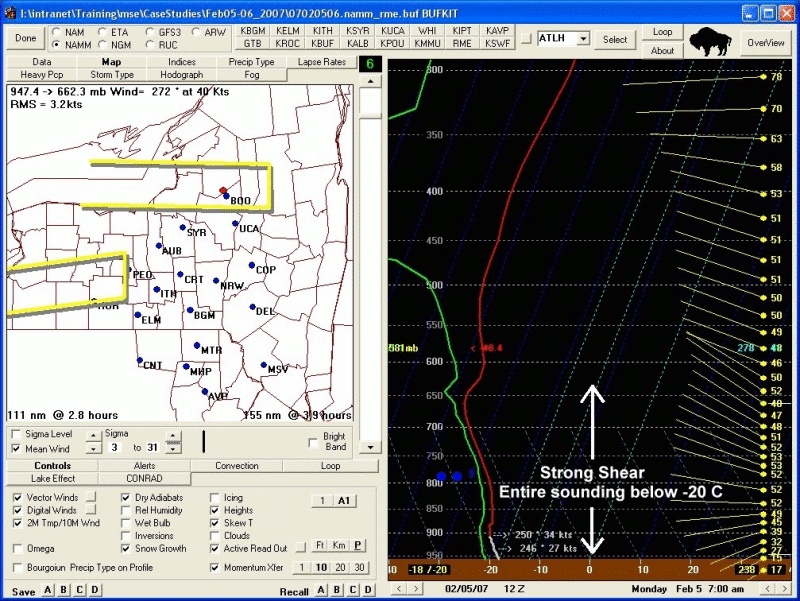
This overview from the 12 UTC, February 5th NAM model, taken at a point in northern Oneida county, shows two maxima of lift, both associated with the passage of the snow band. Omega in contoured in red. The layer with temperatures between -10 and -20 degrees C (the prime layer for dendritic snow crystal growth) is outlined in yellow. The first maxima of upward vertical motion was forecast to be just prior to 18 UTC on the 5th, when the band was forecast to move south across northern Oneida county. The second maxima, between 12 UTC and 18 UTC on the 6th, occurred as the model was forecasting the band to move back to the north. Note that most of the lift was forecast above the prime dendritic crystal growth layer at 18 UTC on the 5th. This would not be a favorable condition for dendritic snow crystals and rapid snow accumulations. Is this what really happened? (remember; this is just a model forecast).Slide 18