Satellite
Notes:
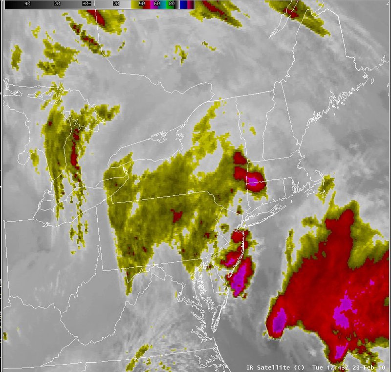
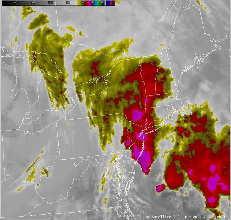
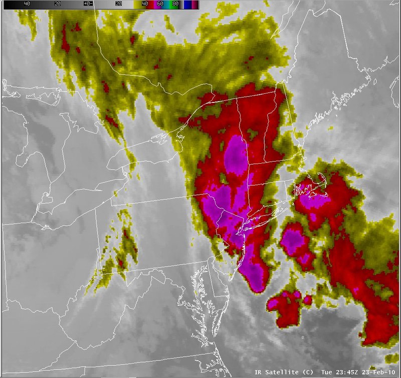
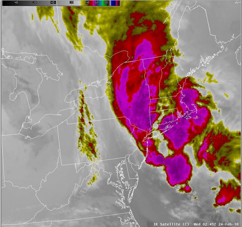
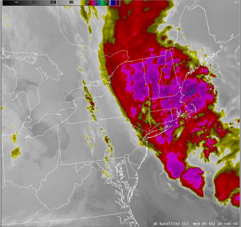
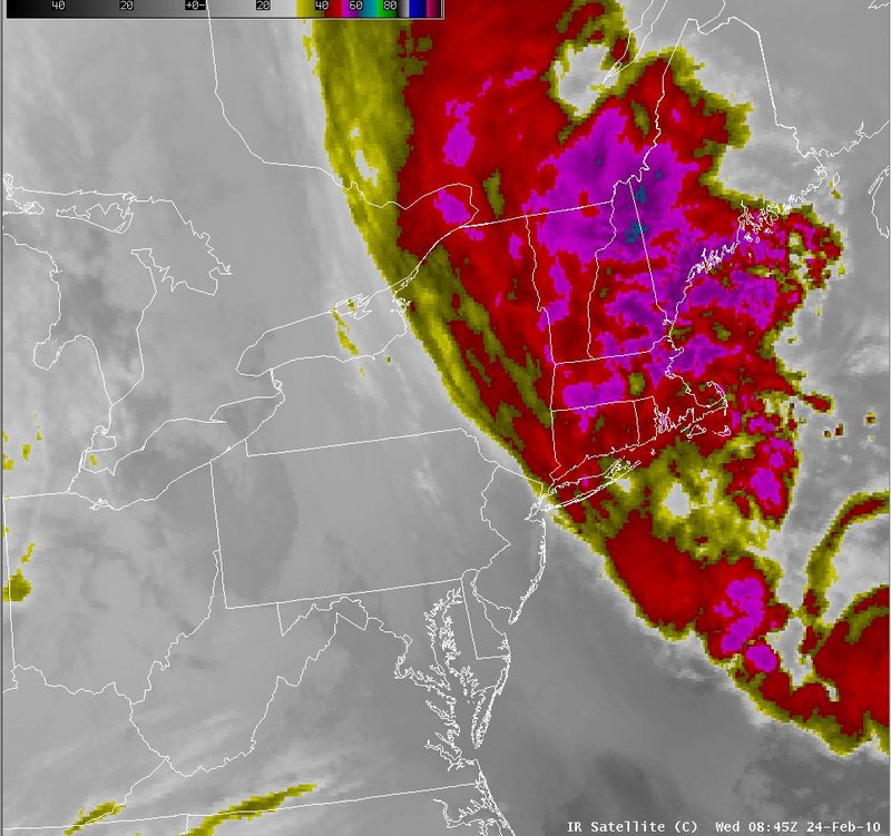
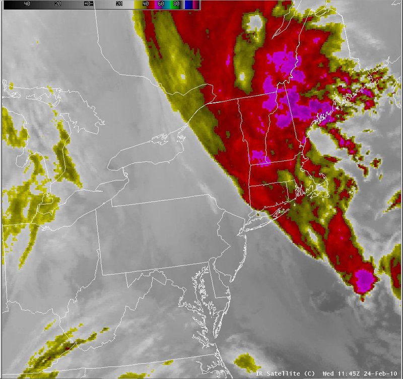
The satellite imagery on these slides indicate rapidly cooling cloud tops over New York and New Jersey during the onset of the event. The cooling cloud tops eventually organized into a comma cloud pattern, while moving northeast across New England.|
Switch images by moving your mouse pointer over the links below...
Valid Tue 1745 UTC 23-Feb-2010 Valid Tue 2045 UTC 23-Feb-2010 Valid Tue 2345 UTC 24-Feb-2010 Valid Wed 0245 UTC 24-Feb-2010 Valid Wed 0545 UTC 24-Feb-2010 Valid Wed 0845 UTC 24-Feb-2010 Valid Wed 1145 UTC 24-Feb-2010 |
|
Slide 15