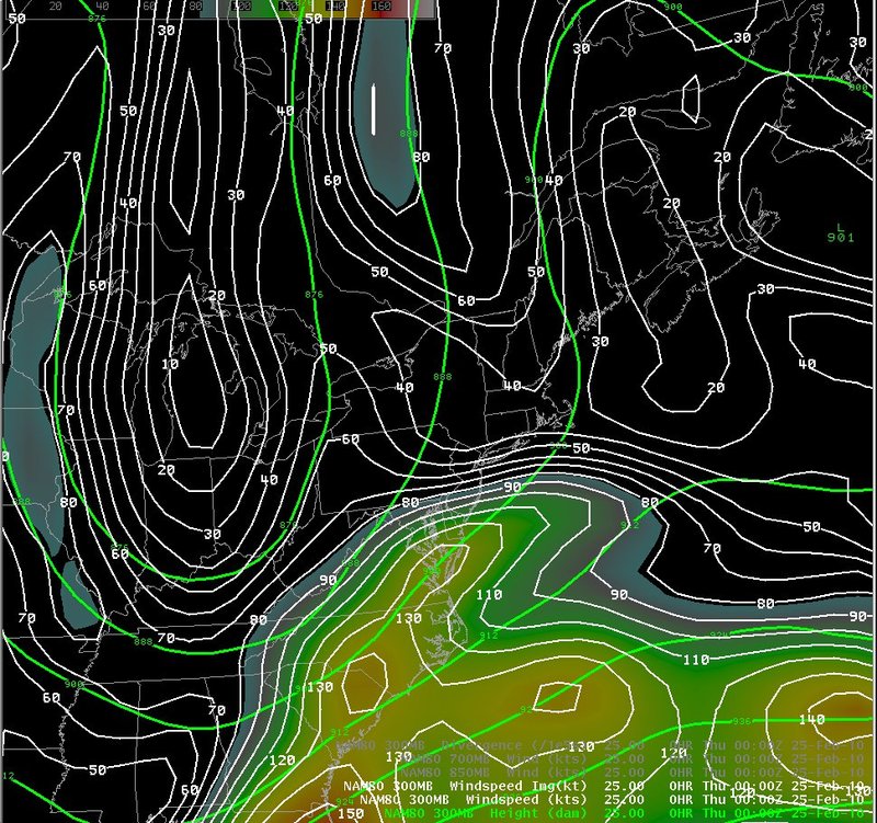
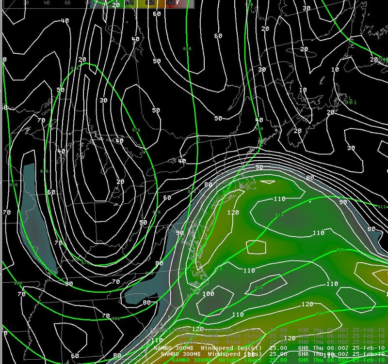
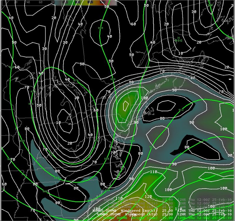
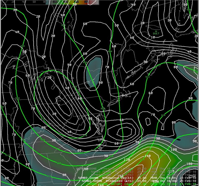
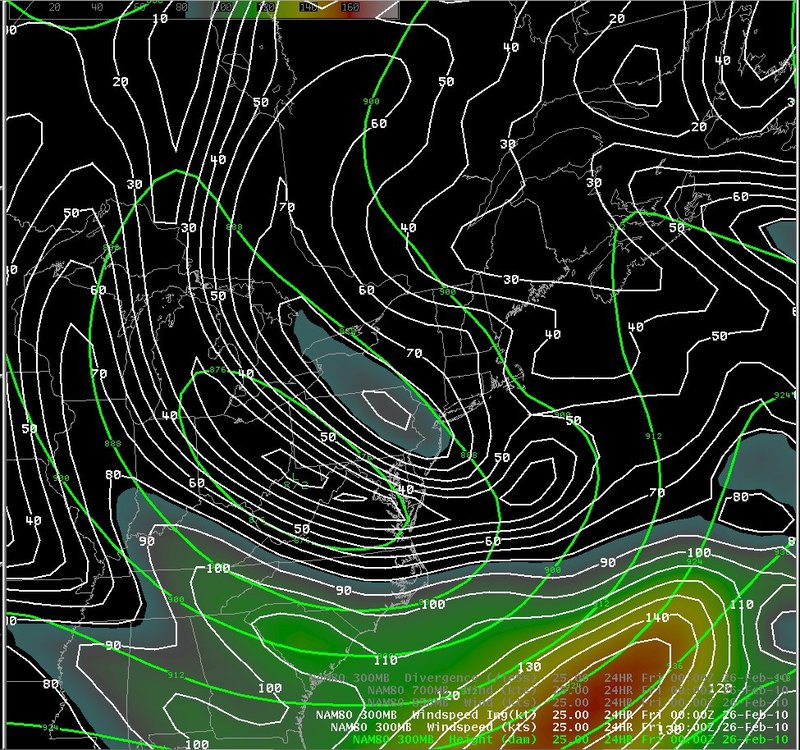
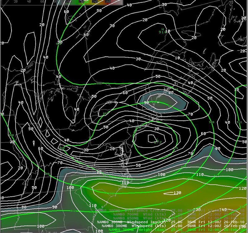
300 mb heights and wind speed
Notes:
This slide shows forecasts of 300 mb heights and vorticity from the 25th through the 26th. An upper level jet streak moved northeast off the southeast U.S. coast early on the 25th, with New York and Pennsylvania in the left exit region of the upper jet. After 12z on the 25th, the upper low closed off over the northern mid-Atlantic region, and most of the upper level jet dynamics were south and east of New York and Pennsylvania.
|
Switch images by moving your mouse pointer over the links below...
Valid Thu 0000 UTC 25-Feb-2010 Valid Thu 0600 UTC 25-Feb-2010 Valid Thu 1200 UTC 25-Feb-2010 Valid Thu 1800 UTC 25-Feb-2010 Valid Fri 0000 UTC 26-Feb-2010 Valid Fri 0600 UTC 26-Feb-2010 Valid Fri 1200 UTC 26-Feb-2010 |
|
Slide 9