Radar
Notes:
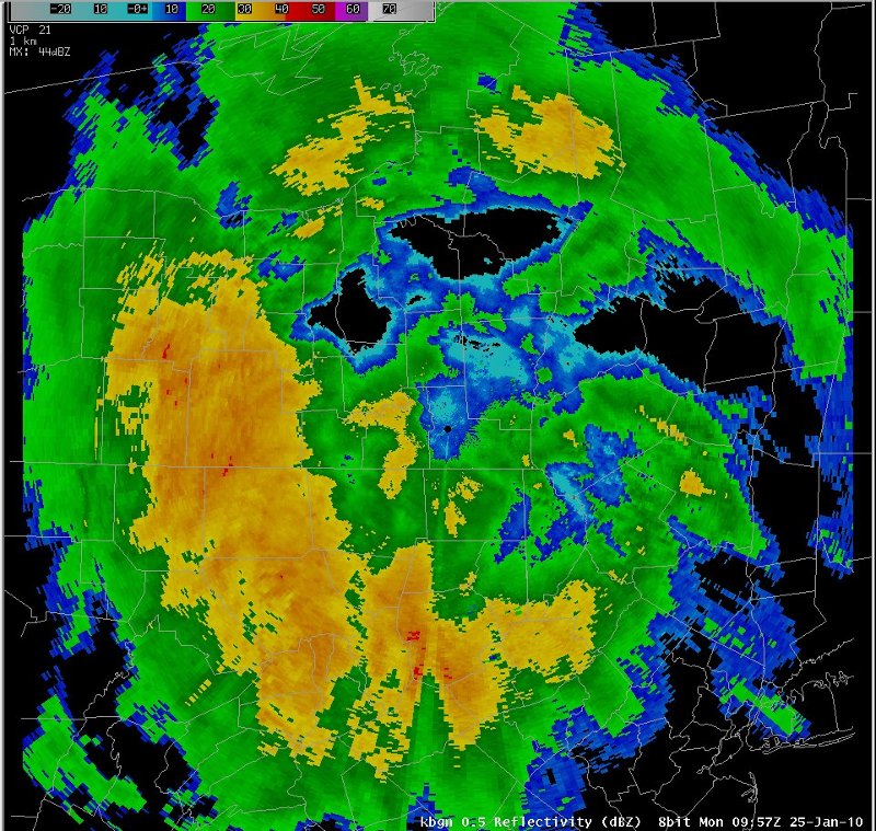
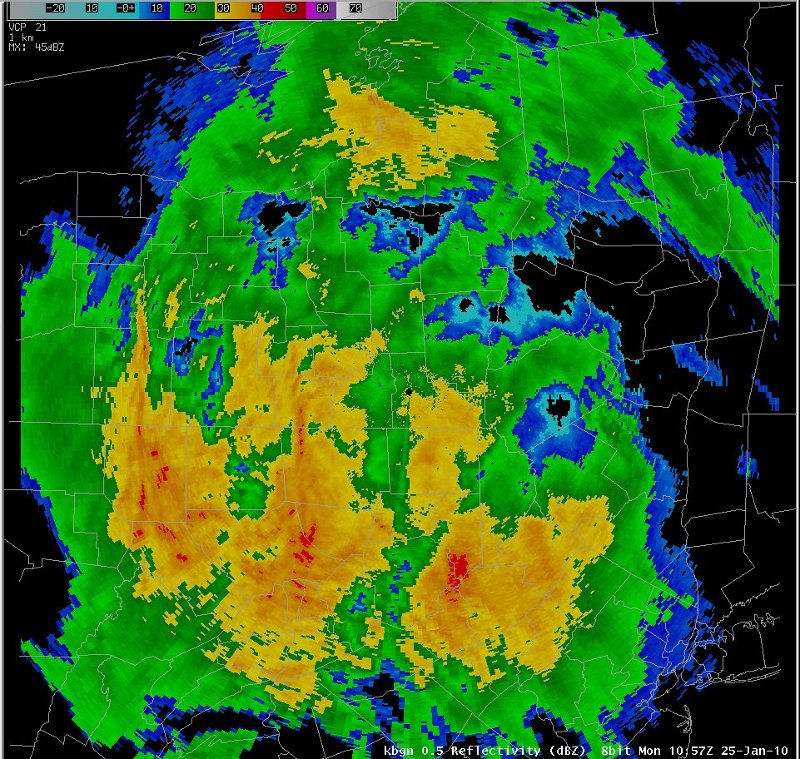
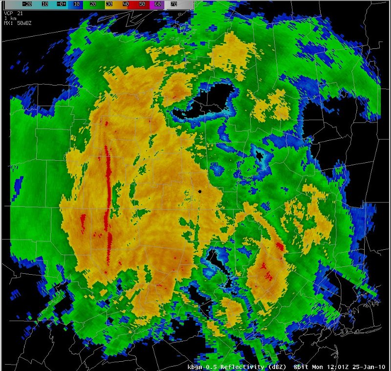
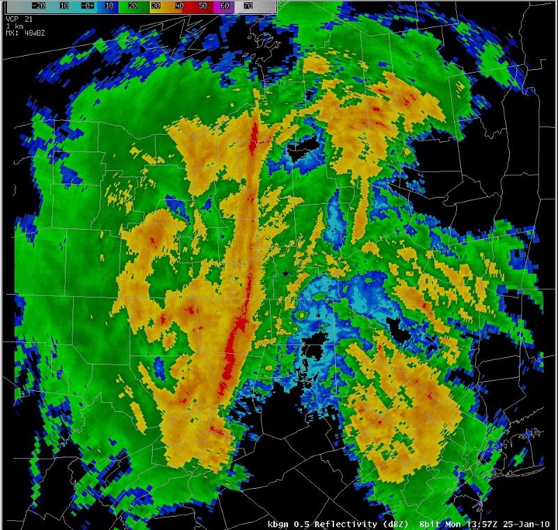
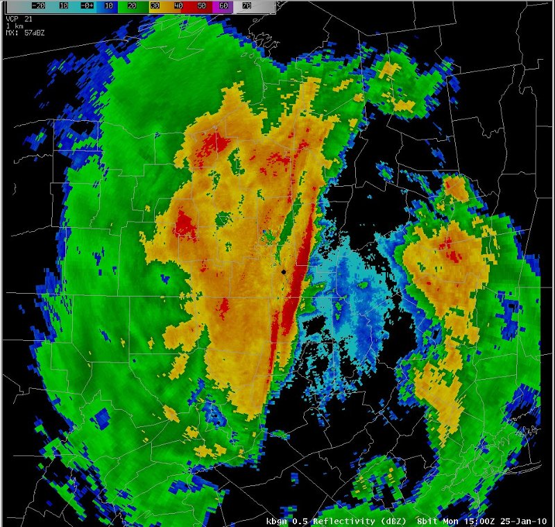
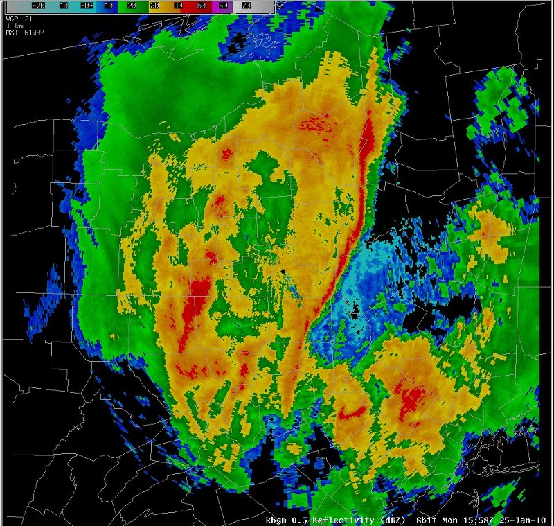
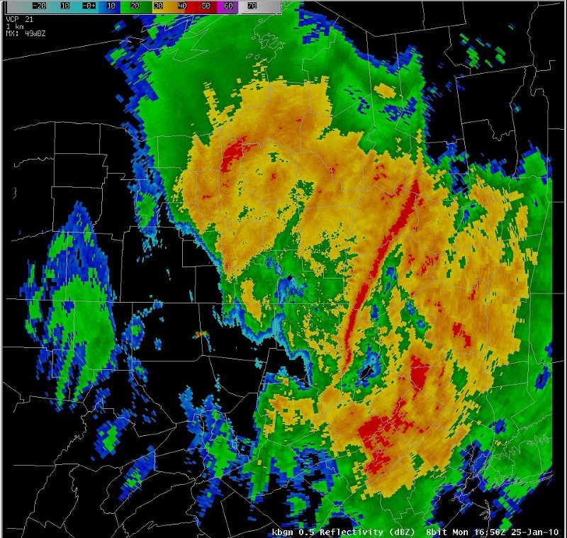
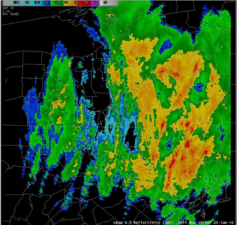
The radar images from this event indicated a band of very heavy rain embedded within a large area of light to moderate rain. The band appeared to enhance as it moved east across central New York.
|
Switch images by moving your mouse pointer over the links below...
Valid Mon 1000 UTC 25-Jan-2010 Valid Mon 1100 UTC 25-Jan-2010 Valid Mon 1200 UTC 25-Jan-2010 Valid Mon 1300 UTC 25-Jan-2010 Valid Mon 1400 UTC 25-Jan-2010 Valid Mon 1500 UTC 25-Jan-2010 Valid Mon 1600 UTC 25-Jan-2010 Valid Mon 1700 UTC 25-Jan-2010 Valid Mon 1800 UTC 25-Jan-2010 |
|
Slide 10