Radar reflectivity loop
Notes:
A broken line of thunderstorms developed over central New York by mid-afternoon. The storms over the Finger Lakes developed a classic "bow-echo" shape, with a rear inflow notch clearly visible over northern Seneca county at 1830 UTC. The line progressed eastward through mid-afternoon, with the southern end of the line developing into a supercell over the Syracuse area by around 1930 UTC. The supercell continued northeast across Oneida county through 2100 UTC, with additional storms developing to the southwest.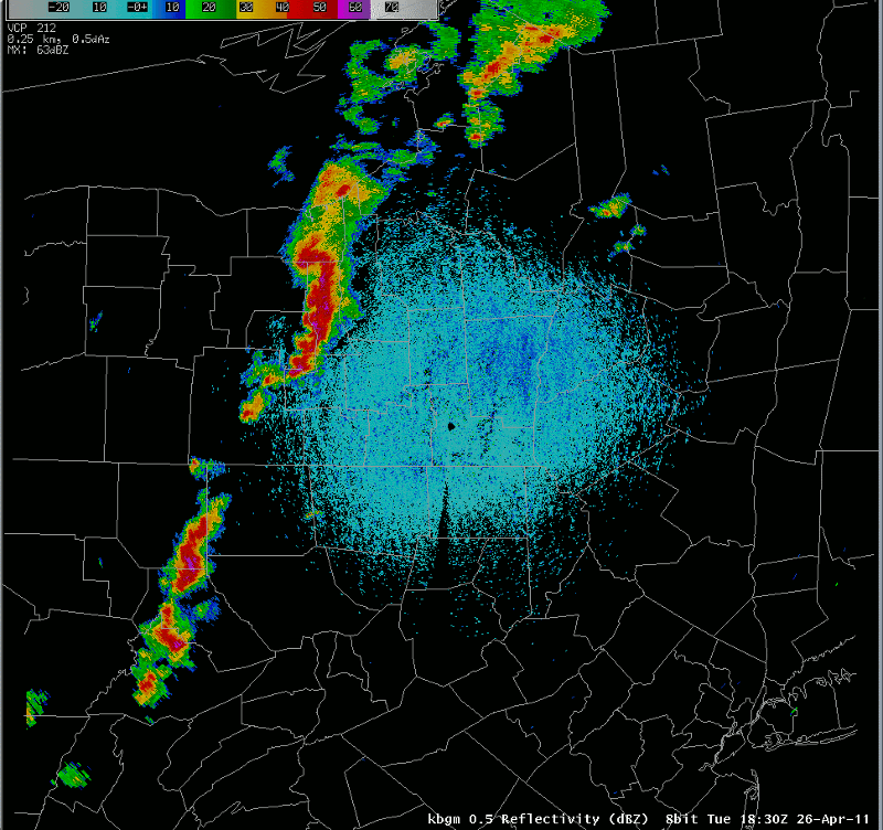
Slide 16