NAM/GFS/ECMWF surface low position comparisons
Notes:
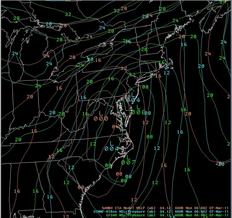
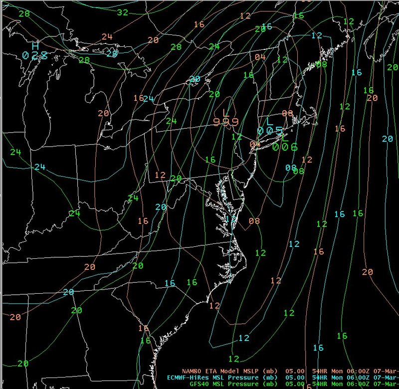
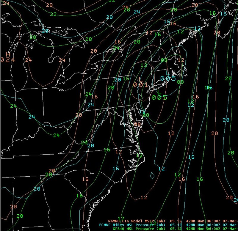
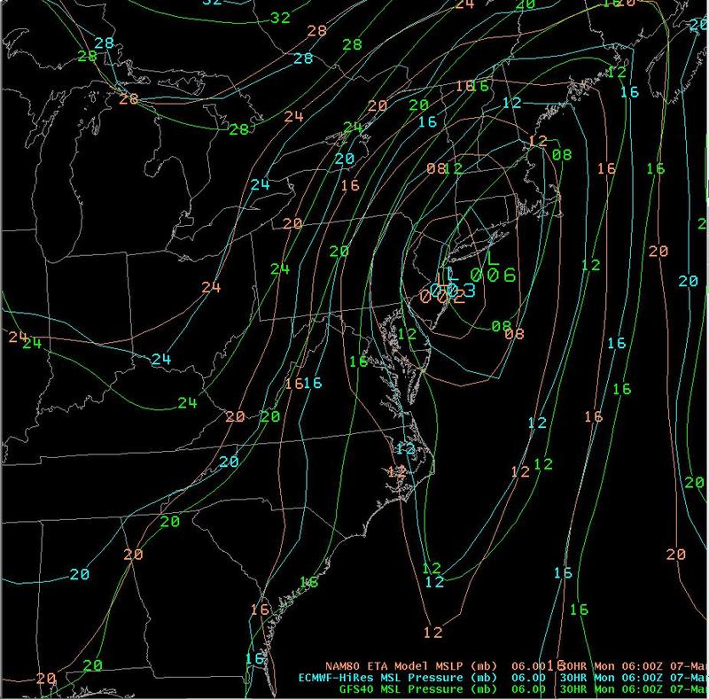
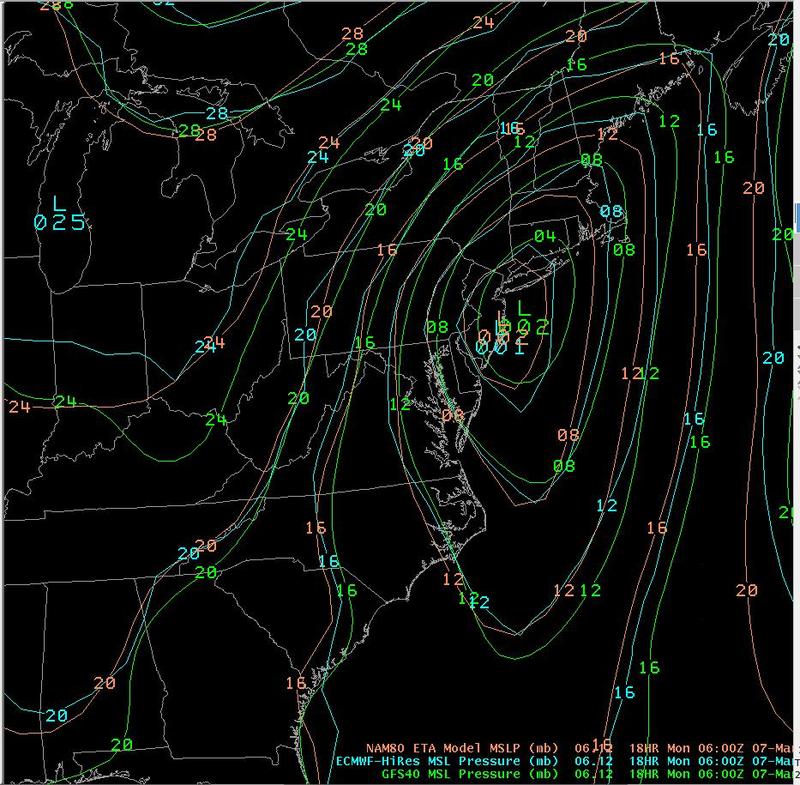
The data on this slide shows relative surface low position forecasts from the NAM (brown), ECMWF (blue) and GFS (green), all valid at 06z on the 7th. This series of slides shows that the NAM was initially farther west with the system, indicating a warmer solution with more rain than snow across central New York and especially northeast Pennsylvania. The ECMWF and GFS were more consistently along or just off the east coast with the surface low center, which turned out to be correct, although both of those models were a little too weak and too fast with moving the low up the coast.
|
Switch images by moving your mouse pointer over the links below...
66 Hour - Valid Mon 0600 UTC 07-Mar-2011 54 Hour - Valid Mon 0600 UTC 07-Mar-2011 42 Hour - Valid Mon 0600 UTC 07-Mar-2011 30 Hour - Valid Mon 0600 UTC 07-Mar-2011 18 Hour - Valid Mon 0600 UTC 07-Mar-2011 |
|
Slide 23