Surface analysis - 21z May 26
Notes:
A surface plot at 21z on May 26th shows the large-scale frontal boundary located from northwest New England southwest to northern Ohio. A north-south oriented trough can be seen extending from central New York southward to western Virginia. Surface dew points downstream of the trough were in the upper 60s, and in the mid 50s to lower 60s upstream of the trough. The trough served as a focus for storm development late in the afternoon on the 26th. The next several slides examine some of the factors that led to the development of a significant squall line with damaging winds downstream from the trough.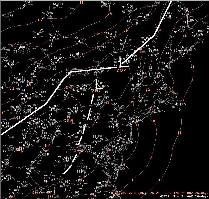
Slide 9