Surface plot and satellite imagery
Notes:
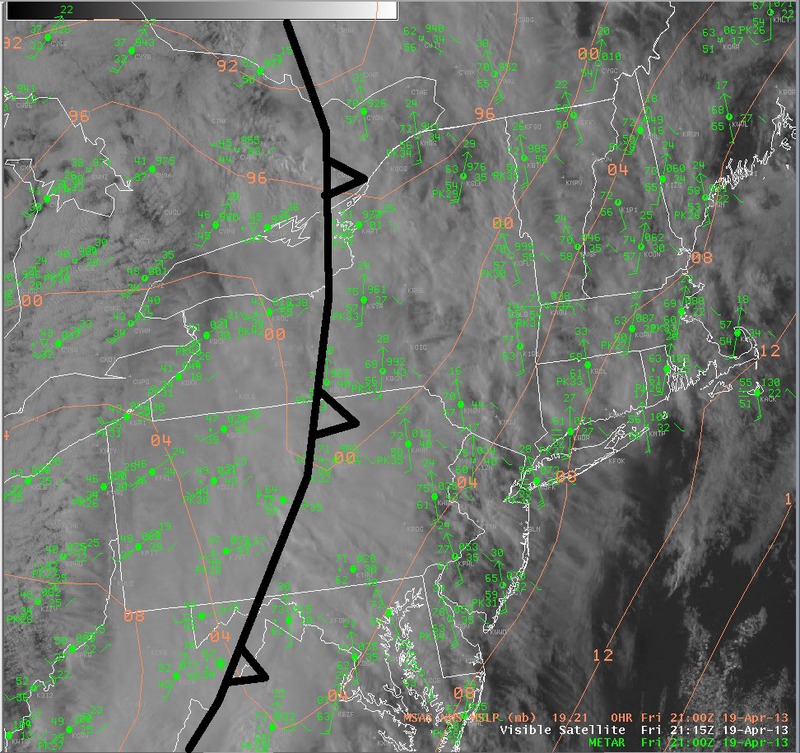
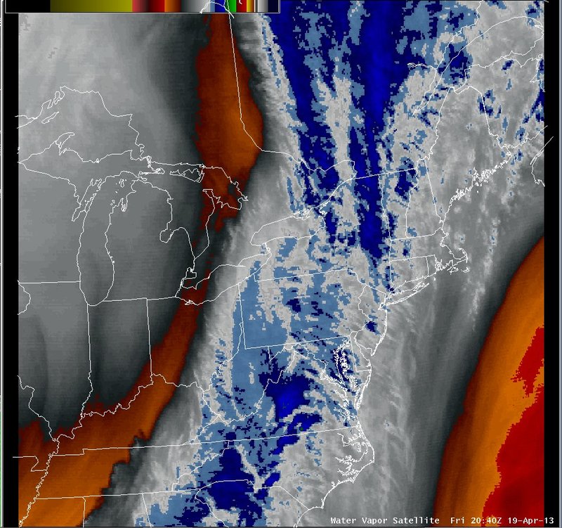
At 21 UTC, the surface analysis (left) on this slide indicates a cold front moving east cross central New York and Pennsylvania. Temperatures ahead of the front were in the upper 60s to mid 70s, with 40s behind the front over the Great Lakes. The water vapor imagery (right) shows a north-south oriented plume of moisture along the front.
Switch images by moving your mouse pointer over numbered buttons...
|
|
|
Slide 14