Radar and observations 00z-05z
Notes:
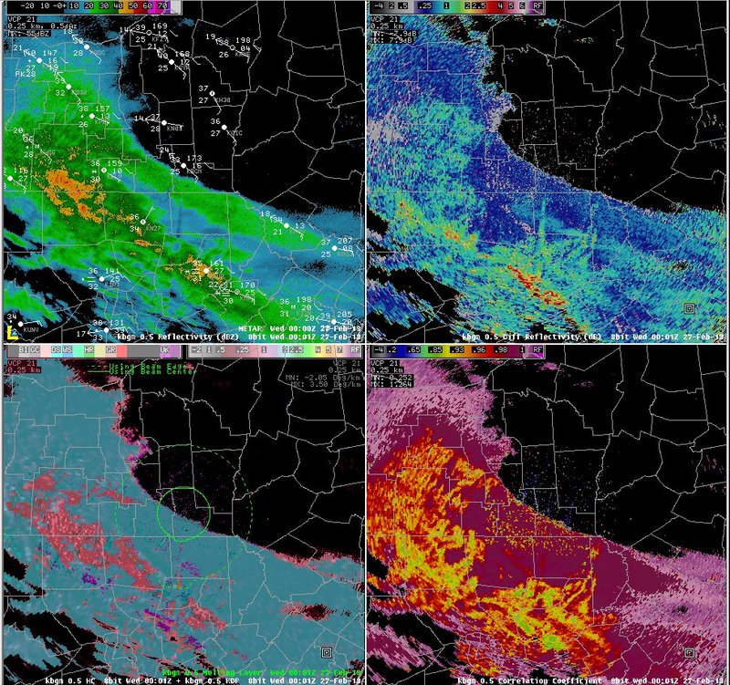
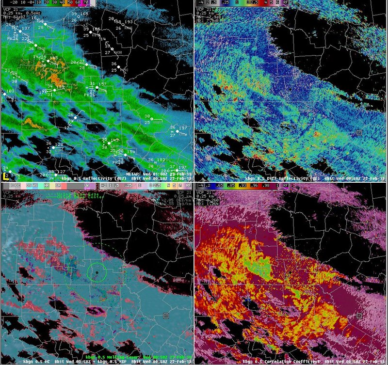
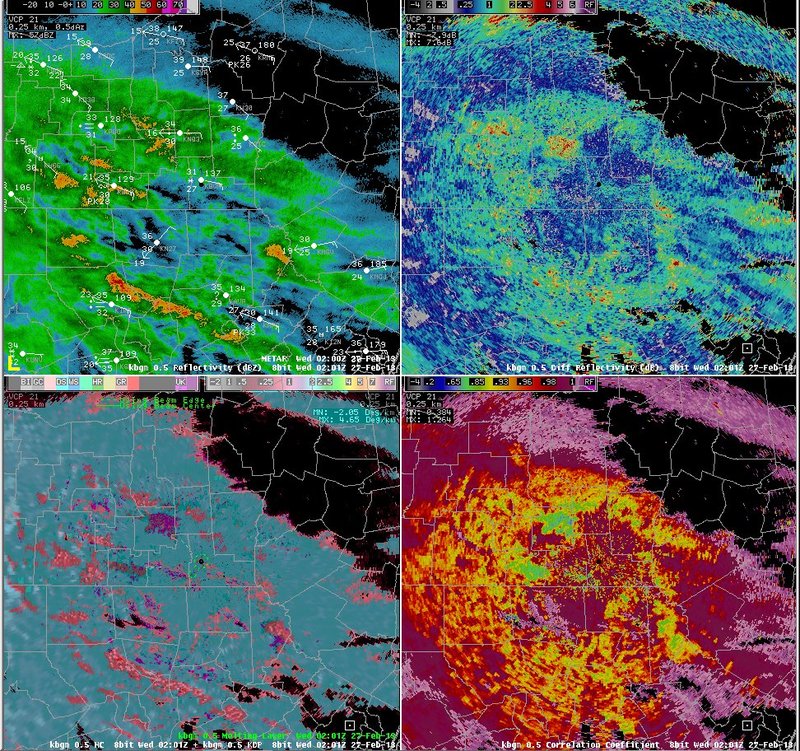
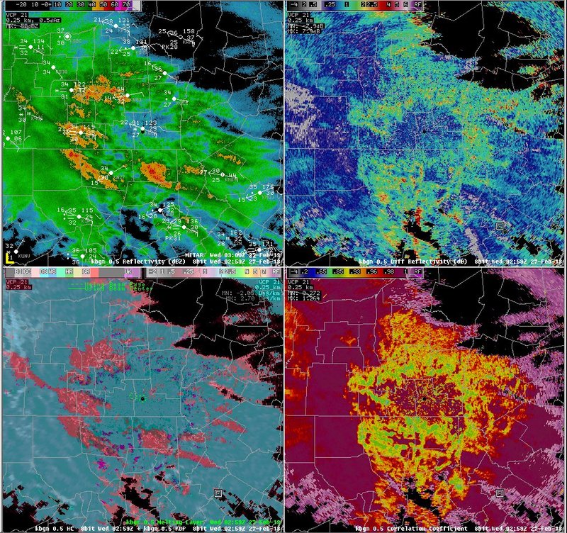
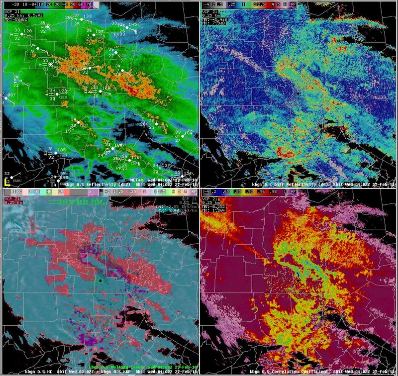
The data on this slide show radar imagery from the evening on the 26th. An initial band was associated with a period of all snow across northern Pennsylvania and southern New during the early evening on the 26th.This band was associated with reflectivities from 20 to 30, ZDR values generally below 0.5, CC values above 0.99, and a hydrometeorological classification of "dry snow". Some melting is indicated near the ground, as the top of the melting layer is shown by the solid circle at 00z and 01z. Later, as mixed precipitation develops, reflectivity values increase, ZDR values increase to between 1 and 3, and CC values fall with large areas below 0.95. The algorithm is still indicating mostly "dry snow" with areas of "graupel". Note that the melting layer has largely disappeared, despite the fact that short-range RAP forecasts indicated a shallow melting layer aloft (next slide), and precipitation type clearly indicated melting aloft.
Switch images by moving your mouse pointer over numbered buttons...
|
|
|
Slide 17