Radar and observations - 17z-18z
Notes:
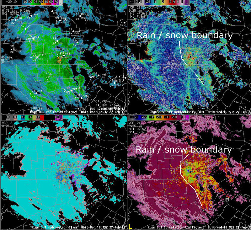
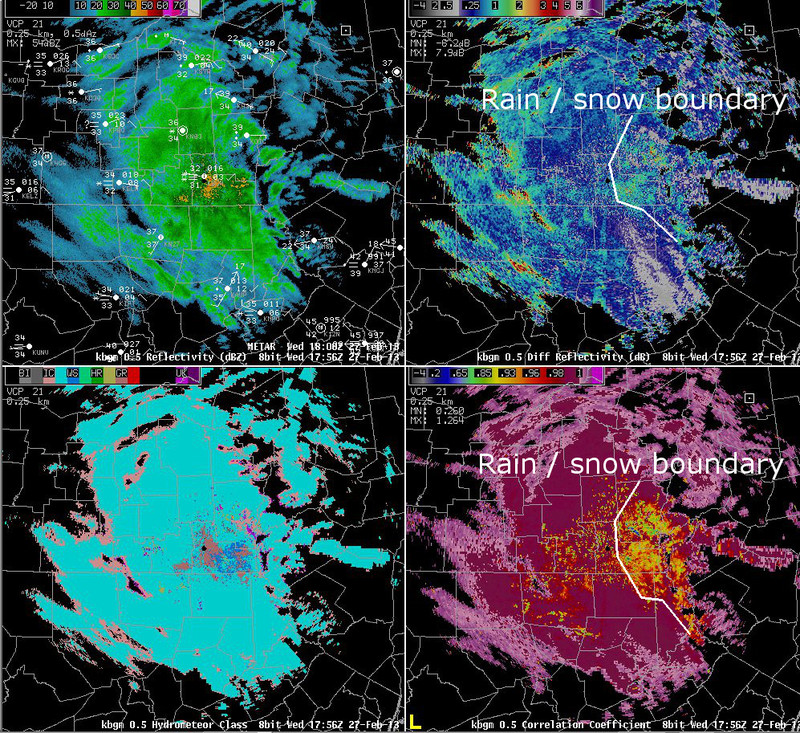
The data on this slide shows radar data during a period when rain was changing back to heavy, wet snow across portions of our area. The data on the first slide is shown from 17z, when rain was being reported at BGM. ZDR values were from 1 to 3 near the radar, while CC values were below 0.95. Farther away from the radar and higher above the ground, the precipitation was likely falling as snow, as indicated by ZDR values mostly ranging from 0.25 to 0.50 and CC values above 0.99. At 18z, precipitation had changed to snow at higher elevations around BGM, including at the radar site. At this time, the higher CC and lower ZDR values had swept east-northeast across the radar site.
Switch images by moving your mouse pointer over numbered buttons...
|
|
|
Slide 19