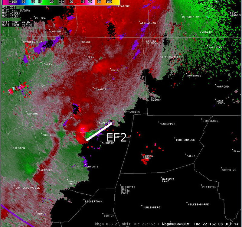
Radar data - 2215z (EF2)
Notes:
Data on the next several slides shows radar imagery from the KBGM WSR-88D. 0.5 degree radar reflectivity is shown on the left and storm relative motion is shown on the right. There appeared to be a wide range of radar signatures associated with the tornadoes in this event. Data from this slide shows imagery from the tornado that touched down over northern Sullivan county and southern Bradford county around 2215 UTC. In this case, the tornado appeared to be associated with a discrete supercell.
Switch images by moving your mouse pointer over numbered buttons...

|
|
|
Slide 26