Radar - 06z - 18z
Notes:
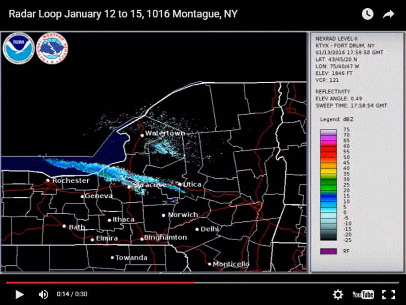
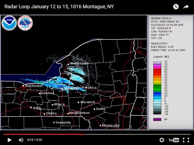
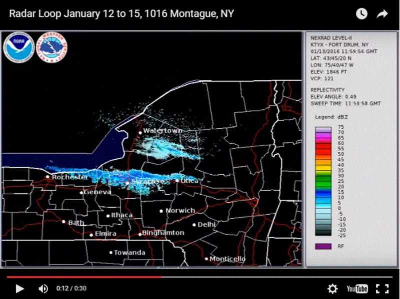
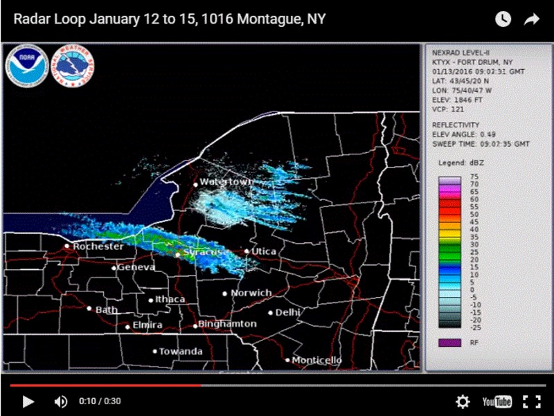
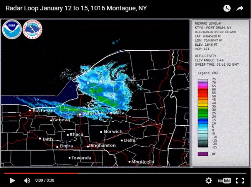
This radar animation showed a persistent snow band from the northern edge of the city, north across the Thruway into southern Oswego county. The southward jog across the southern part of the city that was forecast by some of the high resolution models did not occur. Also note that the heaviest snow appeared to fall just to the north of the ensemble mean maxima of precipitation. This too-far-south model bias has been seen frequently with other lake effect snow events. However, it can be reasonably stated that the analogs, high resolution models and the ensemble were still very useful for forecasters to anticipate the band.
Switch images by moving your mouse pointer over numbered buttons...
|
|
|
Slide 17