4 km NAM 12z run forecasts
Notes:
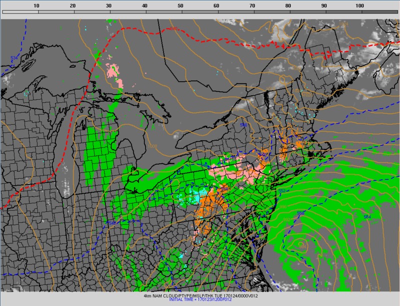
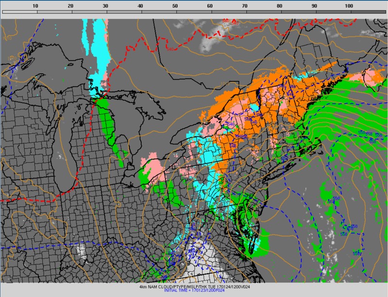
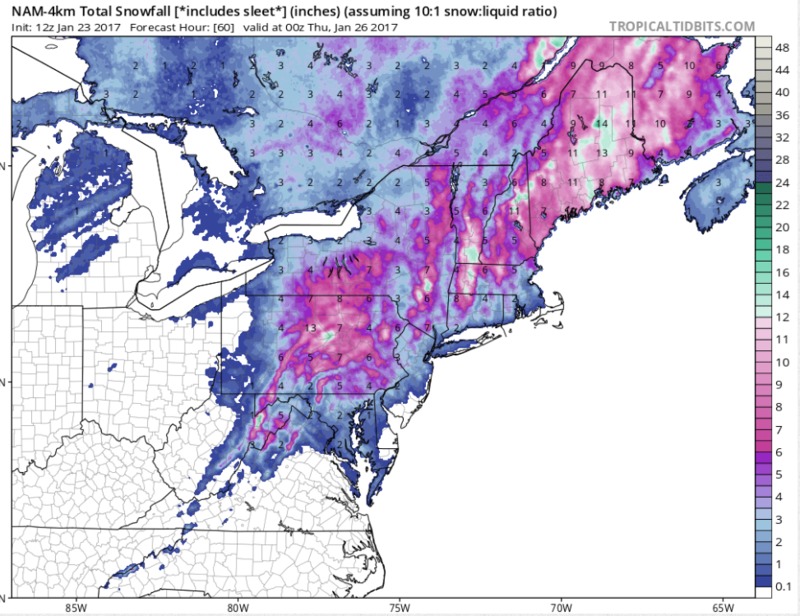
High resolution model forecasts became increasingly available starting with 00z runs on the 23rd. The graphics on this slide show forecast precipitation type from the 4 km NAM nest valid at 00z and 12z on the 24th. A mix of rain and freezing rain is shown moving north across northern Pennsylvania and southern New York at 00z on the 24th. By 12z on the 24th, the precipitation type is snow for the Finger Lakes area, however a mix of precipitation is forecast farther east from Syracuse to Binghamton. The snowfall forecast from the 4 km NAM is shown at the bottom. Despite the predominance of mixed precipitation for central New York, forecast snowfall amounts ranged from 3 to 8 inches for much of the forecast area. Subsequent investigation indicated that these snowfall forecasts are based on the assumption that all “frozen” precipitation in the model will accumulate as snow with a snow to liquid ratio of 1 to 10. Since sleet is a form of frozon precipitation, a ratio of 10 to 1 was assumed, causing an unrealistically high snowfall forecast for an event that would include a large amount of sleet.
Switch images by moving your mouse pointer over numbered buttons...
|
|
|
Slide 14