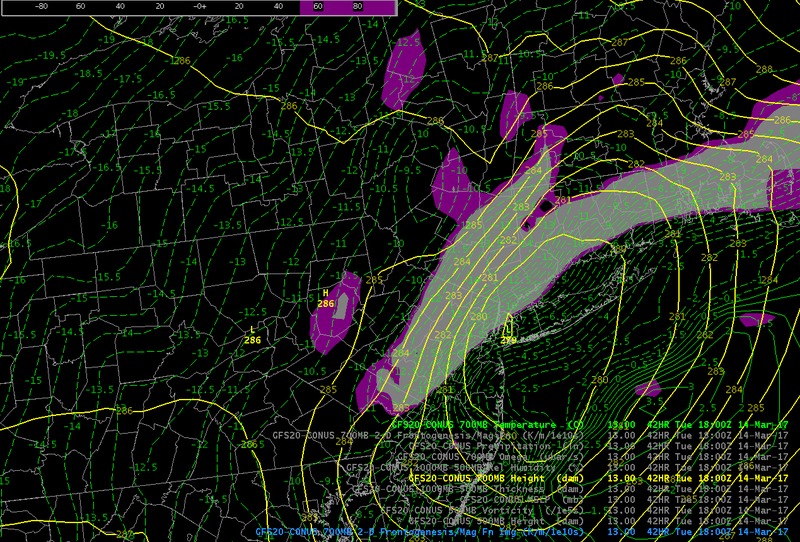
00z March 13 run of the GFS and NAM - 700 mb heights and frontogenesis valid 18z March 14
Notes:
By 00z on the 13th, both models were forecasting strong cyclones at 700 mb near the east coast. In this run, both the NAM and GFS forecast the 700 mb low near or just north of New York City, with a band of frontogenesis extending to the north and northwest of the cyclone center. The GFS cyclone was more compact than the NAM cyclone, with frontogensis northwest of the cyclone confined to New Jersey and the lower Hudson Valley. The NAM was forecasting a broader system with frontogenesis extending a bit farther to the north and west.
Switch images by moving your mouse pointer over numbered buttons...

|
Slide 21

