Surface map - May 2, 00z
Notes:
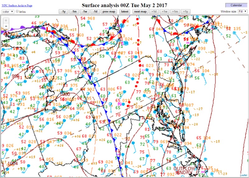
By 00z on the 2nd, a trough / outflow boundary could be seen downstream from the surface cold front over central NY and central NY. This was located at the leading edge of the thunderstorms that were developing downstream of the cold front. The marine air mass was retreating northeast across New England.
Slide 5