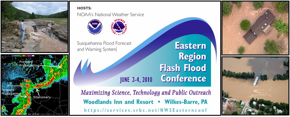
Eastern Region Flash Flood Conference Outcomes
As a result of the Eastern Region Flash Flood Conference, held 2-4 June 2010, several short term needs and resulting actions were identified by attendees. These generally fell into one of four categories: Science, Training, Operations, and Service. These are listed below. In addition, conference attendees identified longer term needs that will take several years to implement and visionary needed to help improve flash flood forecast and warning performance. The longer term needs were also broken into the four categories: Science, Training, Operations, and Service. Visionary was broken into four topics: Social Science, Dissemination, Modeling, and Operations. It was felt that these goals/actions would take the longest to achieve.
Short Term Needs and Actionable Items
Science Needs
- Case Studies: Increase local flash flood case studies for use in training, exercises and drills.
Collaboration with neighboring Weather Forecast Offices (WFOs) or River Forecast Centers (RFCs) on events that have affected both offices’ hydrologic areas can enhance the learning with a broader view. Also, collaboration with universities can bring fresh perspectives and help incorporate emerging science into flash flood forecast and warning operations.
ACTION: (1) WFO Senior Service Hydrologist (SSH) and Hydrologic Focal Points should work with the Science and Operations Officers (SOO) to identify recent local flash flood events to complete case studies. (2) Eastern Region Headquarters (ERH) will facilitate sharing of case studies and lessons learned among the offices.
- Flash Flood Zones: Determine areas that are flash flood prone or pose high risk for flash flooding with tools such as the Flash Flood Potential Index (FFPI).
ACTION: Encourage development of FFPI maps at each WFO using common datasets and GIS applications.
- Modeling: Test finer resolution hydrologic models for gaged basins and explore tools to be used in ungaged sites prone to flash flooding.
ACTION: Follow up on the testing and verifying of KINEROS model, as a new tool for Flash Flood operations.
- Social Science: Increase the understanding of social science as related to flash and river flooding.
ACTION: Make available any related published findings by posting on the flash flood web site. WFOs should consider possible projects with WAS*IS and SSWIM or consider developing a local collaborative effort regarding social sciences with a university. (WAS*IS = Weather and Society * Integrated Studies; SSWIM = Social Science Woven into Meteorology)
Training Needs
- ERH:
- Identify key research already completed that offices should train on and use to improve situational awareness and detection of developing flash flood events.
ACTION: Coordinate refresher training on the use of Flash Flood Monitoring Program (FFMP), including implementing suggestions for improvements that were identified during the conference.
- Examine the presentations provided during the conference (available on line) for recommended use in training.
ACTION: (1) Promote usage of the concepts from the workshop by coordinating training materials to be used by WFO staff. (2) Make arrangements for availability of presentations from original speaker(s) to NWS offices via webinar.
- Develop flash flood best practices reference Wiki web page.
ACTION: ERH will host a Wiki best practices web page. WFOs will input best practice strategies to the Wiki for sharing. ERH will review best practices to be posted.
- Local Offices:
- Develop flash flood best practices strategies.
ACTION: (1) Work to improve flash flood situational awareness by developing aids such as a pre-event checklist and Intranet Flash Flood Wiki which will include proven tools and methodologies. (2) Make use of strategies identified during the conference and post them to the web site [WFO Binghamton is coordinating this action]. (3) Add new success stories and comments to the flash flood best practices Wiki page to share region-wide.
- Develop training material oriented to WFOs staff on ensemble interpretation of information produced by River Forecast Centers (RFCs) regarding Meteorological Model Ensemble Forecast System (MMEFS).
NWS Operational Needs
- Site-Specific Models: Increase use of site-specific hydrologic models at WFOs. Evaluate the incorporation of high resolution quantitative precipitation estimate (Q2) provided by RFCs and updates of state variables for SAC-SMA model.
- Flash Flood Monitoring Program (FFMP): Increase use of FFMP.
ACTION: (1) Promote use of “Forced Flash Flood Guidance” in FFMP-A for urban areas. (2) Offices should follow steps to get FFMP on the Weather Event Simulator (WES) for use in practice cases and drills.
- Radar: Investigate opportunities to improve Quantitative Precipitation Estimate (QPE) by testing locally derived Z-R relationships.
- Grids: Effective utilization of the different products available in gridded format by eliminating duplication of efforts. A classic example is HPC, RFCs, and WFOs all producing QPF.
Service Needs
- Products:
- Consider low- and high-end NWS users by providing graphical as well as text information.
- Help RFCs on improving consistency of Flash Flood Guidance (FFG) at the service area boundaries.
- Use Enhanced short-term to update graphical products to further focus on risk area.
ACTION: Increase RFC/WFO collaboration in quantitative precipitation forecasts (QPF) especially during high-impact rain events.
- NWS web sites:
- Avoid as much as possible the usage of acronyms and jargon in the web pages.
- Streamline web pages and web products so they are very consistent between WFO websites.
- AHPS and Inundation Mapping Services:
- Include additional features in the NWS inundation mapping. It is desirable that users could search by town and/or street address.
- The national “rivers” map needs improvements and having Statewide/basin-wide maps would be of great help.
- Consider all available information on Inundation maps. It would be helpful to have a portal to all available maps.
- Gauges:
- Support US Geological Survey in their efforts to maintain the river gaging system.
Long Term Needs
Science Needs
- Research: Encourage and support collaborative research and the transfer of research into operations.
-
Develop collaboration between NWS meteorologists, hydrologists and social scientists to plan and implement studies focused on increasing the public's response to warnings.
-
Work collaboratively within NOAA and with the university community to investigate phenomena that are known to be associated with excessive rainfall, such as PREs, closed lows, terrain enhancement, ice jams and backward propagating convective systems. Investigation should focus on developing techniques that allow forecasters to anticipate these events in the 0-24 hour time frame.
- Perform local studies to document the effect of dual polarization radar on Quantitative Precipitation Estimate (QPE) in different locations around the country.
-
Continue development of accurate tools for QPE such as Q2.
-
Integrate dual polarization radar into QPE systems such as Q2.
- Modeling: Continue to improve forecast models by:
-
Working toward improvement in the performance of distributed hydrologic models.
- Implementing ensemble forecasting techniques into hydrologic models including site specific models.
- Improving QPF from high resolution models that explicitly produce convective precipitation.
- Developing techniques to better simulate urban effects into hydrologic models.
- Utilizing the benefits of increasing resolution in hydrologic models including upgrading/improving RFC hydrologic models to handle one hour time steps.
- Improving modeling for snow melt runoff.
- Improving real-time soil moisture data and incorporation into models.
- Validation: Provide research data or risk reduction/demonstration results that validate a proposed use of a concept or methodology, such as “warn on forecast,” or performance of a new model or software support tool.
NWS Operational Needs
- AWIPS/AWIPS2: Expand use of tools in AWIPS that allow forecasters to assess whether large-scale patterns are favorable for excessive rainfall. This includes forecasts of anomalies. (AWIPS is the name for the NWS’s computer system used in WFO operations.)
- Ensembles: Expand availability and use of ensemble data that allow forecasters to assess the probabilities and predictability associated with potentially heavy rain producing weather patterns. Need high resolution ensemble modeling.
- Satellite/Remote Sensing: Increase remote sensing capabilities (demonstrated at the conference for things such as tidal flooding and ice build-up) into operations and into hydrologic models.
- Weather Event Simulator (WES): Incorporate hydrologic service applications (FFMP, Hydroview, RiverPro) as part of the baseline into the WES so that offices can train, review cases, and test methodologies without every office having to spend a lot of time trying to get it to work (as is the case with FFMP) .
- Real-time Data: Continue expansion of CoCoRaHS, Skywarn spotters, and alert rain gauges in to strategic locations to support areas of radar beam blockage issues and areas in support of small basin modeling for site-specific. (CoCoRaHS = Community Collaborative Rain, Hail, and Snow volunteer network.)
- Warning Capabilities: Develop a method to allow forecasters to issue flood/flash flood warnings by basin versus by polygon.
- Gridded Flash Flood Guidance: Needs to be expanded to not just forecast water out of bank but also moderate and major flood levels. Need greater resolution and more frequent updates. Need to improve gridded flash flood guidance especially during the cool season.
Training Needs
- Nationally: Work with WDTB to develop a flash flood AWOC similar to the Severe and Winter AWOCs.
- Regionally (or nationally): Identify current research that should be applied to operations and develop appropriate tools and training materials for forecast staff. Publishing research in journal articles is a step in communicating it, but in itself is not enough to get it used operationally.
- Local Offices:
- Use case study reviews and a flood catalog (mentioned in short term science needs under flash flood zones) to improve situational awareness and understanding of risks in their forecast area.
- Provide training on climatological anomalies with local examples of how these fields can benefit forecasts, watches and warnings.
Service Needs
- Web Service: Improvements in web presence via web graphics and use of mobile dissemination are needed.
- Understanding Customer/Partner Needs: Need ways to find out our customers’ needs to better serve.
- GIS: More KML products such as stream/river inundation mapping made available.
- Education and Outreach:
- NWS needs to increase work with State Departments of Education on flood preparedness and safety education efforts (teach people while they are young).
- Increase users (EMs, Media, public) awareness of the vast amount of information contained within the NWS websites via webinars and meetings.
Visionary Needs
- Social Science: More work is needed to improve how information is communicated to the public in a manner that elicits the appropriate response. This requires improved consistency in how flood risks are communicated by NWS, emergency management, flood plain managers, and other officials. More social science studies need to be done in more parts of the country. We need to learn how/if people respond to warnings and the reasons for why they do not respond. There is still a big gap between the warnings we issue and actions taken by the public.
- Improved Dissemination: The NWS should proactively seek to provide weather information in formats and methods that can be disseminated using emerging technologies and information channels. Current examples include getting information via texts, tweets, Facebook, and RSS feeds; use of Common Alert Protocols (CAP); and viewing graphics and information on mobile smartphones.
- Modeling: Have a coupled atmospheric, land surface, snow, and rainfall-runoff model running for gaged and ungaged points down to the small basin level in hourly time steps and providing ensemble forecast uncertainty information.
- Operations:
- Develop scientific methodologies and tools that allow forecasters to express probabilistic information on heavy rainfall and flood potential in products and forecasts.
- Need better visualization tools to aid forecasters in handling the vast amount of data.
Please send comments and questions to Barbara Watson
|