00Z 250 mb Divergence
Slide 22 of 52
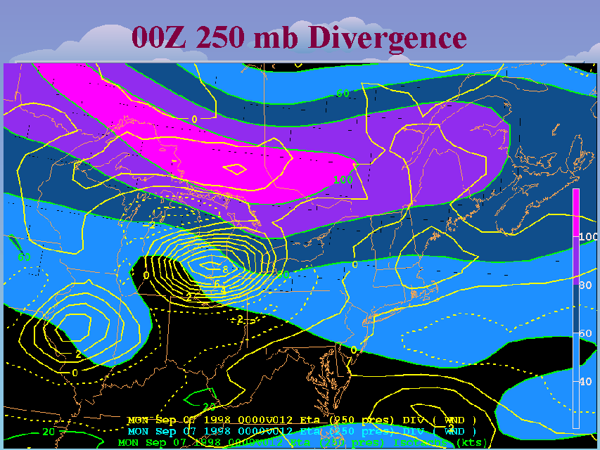
This slide depicts the 12-hour Eta forecast 250 mb divergence field and isotachs valid at 00Z. Very strong divergence is indicated across southeast Michigan and extreme southern Ontario. This signature of upper level forcing, coupled with the low level lift provided by the advancing cold front, indicated the potential for synoptic scale ascent through much of the troposphere. As these features moved eastward over New York, the cooling associated with this large scale ascent could potentially errode the capping inversion, allowing the low level instability in place to be released. Also note that the location of this area of strong divergence is roughly immediately south, or to the right of the core of the jet streak. This does not fit the "straight jet streak" conceptual model of divergence in the front left and right rear quadrants of the jet streak.


