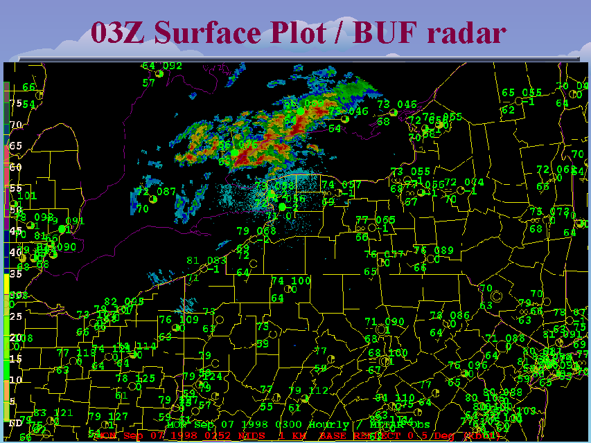
03Z Surface Plot / BUF radar
Slide 23 of 52
The 03Z (11 pm) surface analysis indicated warm and very moist air coninued across New York state. The Buffalo, NY WSR-88D at this time indicated the thunderstorms that earlier developed over Michigan and lake Huron were now approaching Lake Ontario. Note, the Lake Ontario water temperatures usually reach their climatological maximum (in the upper 60s to around 70 degrees) during earlt September. Thus, unlike conditions during most of the summer, the storms would probably not encounter air over the lake that was substantially more stable than that over the land. In addition, the storms could potentially interact with the lake/land breeze boundaries that likely existed near the lake shores.


