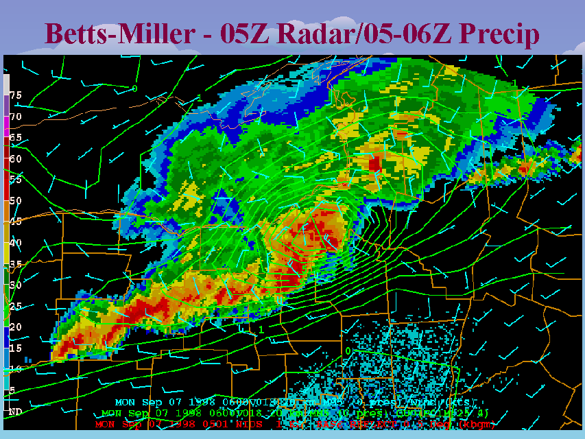
Betts-Miller - 05Z Radar/05-06Z Precip
Slide 49 of 52
This is the 0501Z (1:01 am) BGM radar image overlaid with the 1-hour forecast accumulated precipitation from 05 to 06Z (1:00 to 2:00 am), and the 06Z forecast surface winds from the Betts-miller MM5 run. The Betts-Miller run was a tad (about 30 minutes), which is why I have offset the radar slightly from the mid-point of the precipitation forecast period. However, the simulation appeared to capture the spatial and structural details of the developing bow echo extremely well. The observed track of the bow or comma head corresponds almost exactly with the forecast rainfall maximum, and the location and orientation of the tail of the bow echo is also accurately simulated. While 20 km horizontal resolution is not sufficient to generate surface winds of the magnatude actually observed, the structure of the simulated wind field also appears very realistic.


