Post 1 AM Severe Weather Reports
Slide 6 of 52
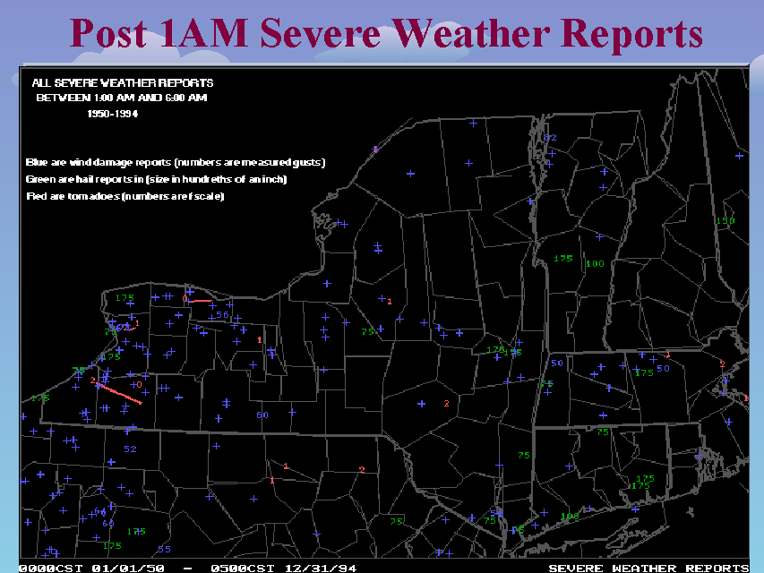
This slide depicts all severe weather reports between 1:00 AM and 6:00 AM across New York state and surrounding areas from 1950 through 1994. RED indicates tornadoes (numbers are F-scale). GREEN indicates hail reports (size in hundreths of inches). BLUE indicates wind damage reports (+) or wind gusts (in knots). Note how most of these late night events are in western New York. These are often associated with mesoscale convective systems (MCSs) that tend to drop southeastward from lower Michigan.


