| Created with the Web Accessibility Wizard |
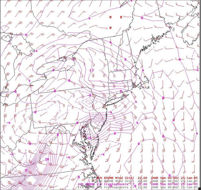
22/00 UTC GFS 700 mb frontogenesis and 850 mb wind forecasts valid 23/00 UTC.
Slide Links:
Speaker Notes:
The maximum of frontogenesis in the GFS forecast is located slightly south of the frontogenesis in the Eta forecast, with a slightly lower magnitude. The associated low-level southeasterly flow is also slightly less (around 40 kts). The trend of the GFS being slightly weaker with mid-level frontogenesis, and weaker with the associated low-level jet was also observed with the February, 2003 (President's Day) storm.