First page Back Continue
Last page
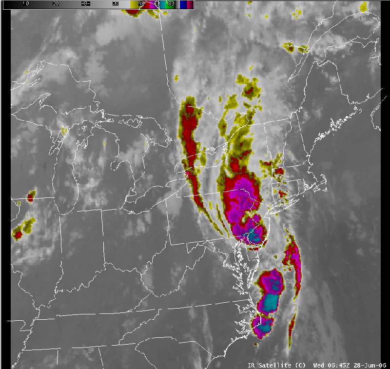
Satellite imagery 6/28 06 UTC.
Notes:
The event ended during the morning on the 28th, as an area of enhanced clouds, associated with a tropical depression, moved north across New Jersey and eastern Pennsylvania. The heaviest rain with this feature fell across eastern Pennsylvania and New Jersey. Had this system tracked just 50 to 100 miles farther west, the river flooding in south central New York would have been worse (more on the river flooding later in this presentation)
.