|
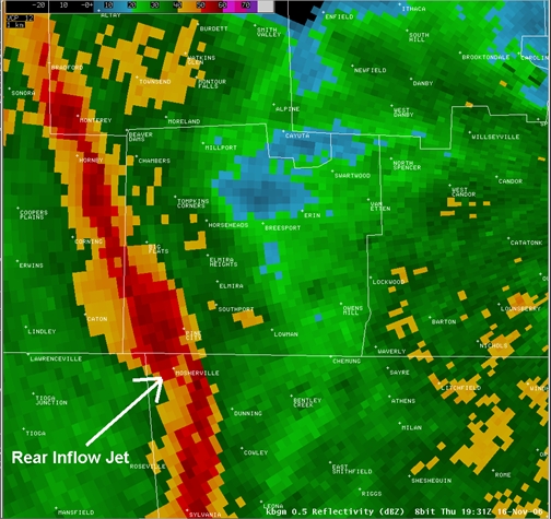
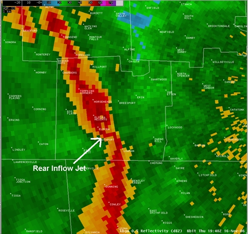
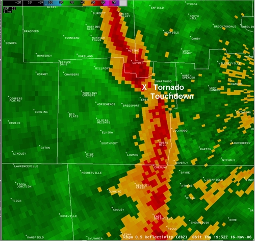
Radar reflectivity associated with F1 tornado in northern Chemung County
|
|
|
Slide Links:
Speaker Notes:
The data on the next few slides focuses on radar data associated with the F1 tornado over Chenango county. The reflectivity data on these slides shows a bowing convective line moving northeast across Chemung county. The tornado occurred on the north side of a break in the line. This "broken S" radar reflectivity signature has been identified in many other cases featuring damaging winds and weak tornadoes. Note that several other "broken S" signatures also occurred on this day, with no tornado touchdowns. Experience with these features indicate that they occasionally, but rarely, produce tornadoes, however they frequently producing damaging straight-line winds.