Cross-sections – omega and negative EPV
Notes:
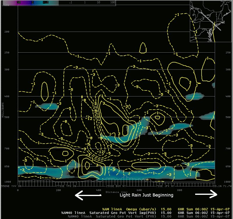
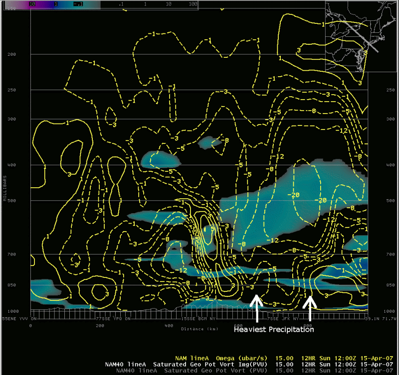
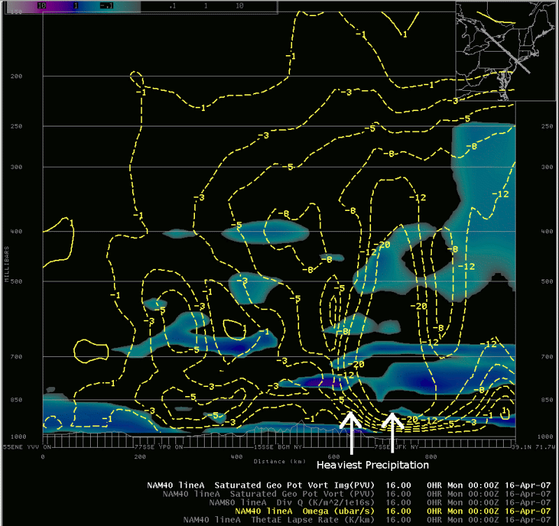
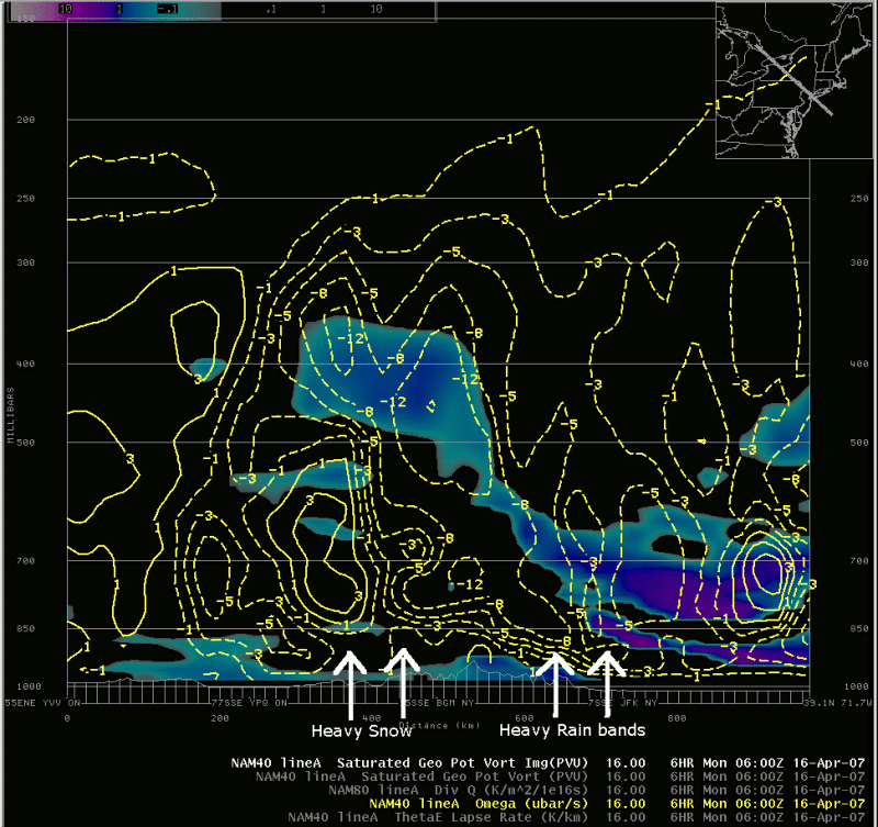
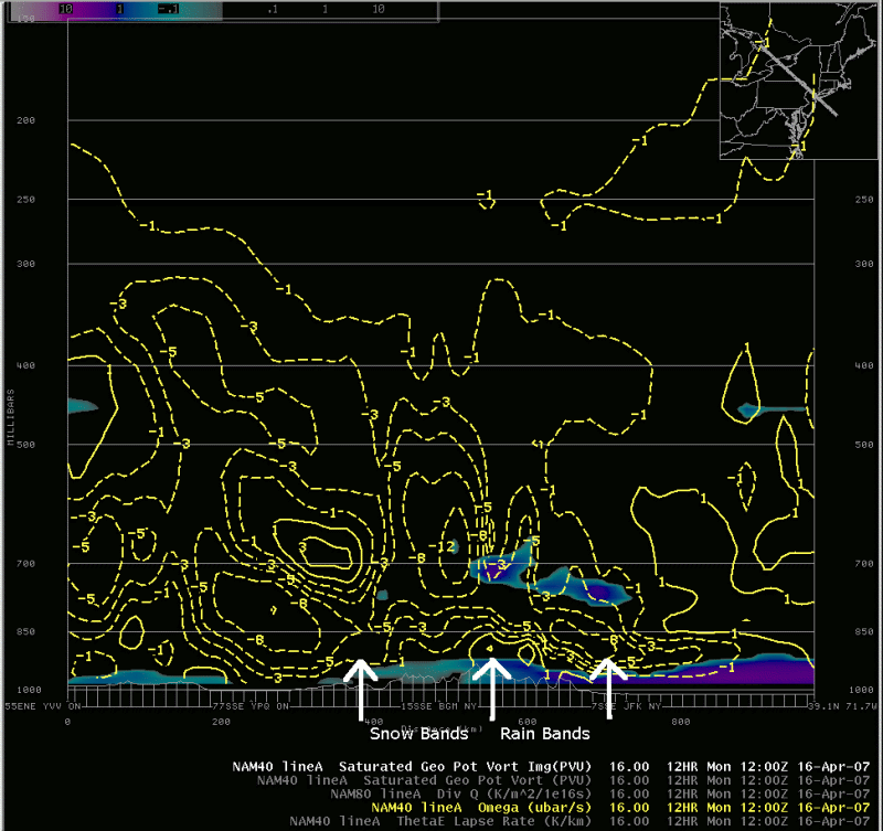
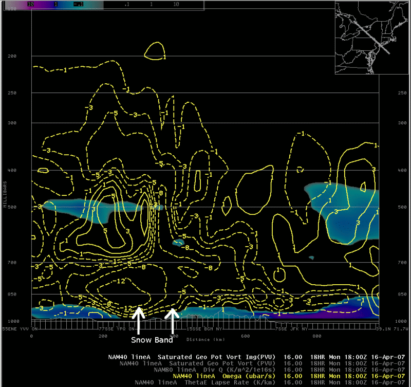
Cross-sections of model forecasts of vertical motion (yellow contours; upward motion indicated by negative (dashed) values) and negative EPV (blue shading) indicate areas where intense lift was forecast to become co-located with reduced stability, indicating the potential for bands of heavy precipitation. The best co-location between lift and reduced stability was forecast over the southeast part of the cross-section (southeast NY) between 12 UTC and 00 UTC. This was a location and time where very heavy rain was reported. At 06 UTC, a region of co-located strong lift and negative EPV between 500 and 400 mb can be seen above an intense snow band over south central New York. After 12 UTC, forecast areas of elevated, negative EPV diminished along the cross-section, however bands of heavier snow continued across the area beyond 18 UTC.|
Switch images by moving your mouse pointer over the links below...
Sun 0600 UTC 15-Apr-2007 Sun 1200 UTC 15-Apr-2007 Sun 1800 UTC 15-Apr-2007 Mon 0000 UTC 16-Apr-2007 Mon 0600 UTC 16-Apr-2007 Mon 1200 UTC 16-Apr-2007 Mon 1800 UTC 16-Apr-2007 |
|
Slide 11