First page Back Continue Last page Research
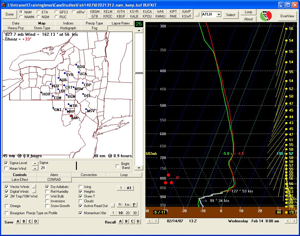
February 13, 12 UTC 25 hr NAM forecast valid at AVP
Notes:
Model forecasts for northeast Pennsylvania were indicating the potential for several hours of heavy sleet well in advance of the storm. This forecast sounding, from the 12 UTC, February 13th run of the NAM model valid at AVP at 13 UTC on the 14th shows a warm layer between 850 and 800 mb, indicating the potential for melting then re-freezing of snowflakes into sleet. This sounding was typical of the profiles that were being forecast across northeast Pennsylvania for the morning of the 14th.