6-hour QPF valid 00z 11/19
Notes:
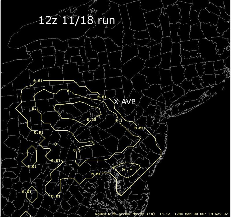
Despite some indications for banded snowfall over northeast Pennsylvania from the 12 UTC NAM, the data on this slide indicates that the NAM model was not forecasting much precipitation over northeast Pa. The first image shows NAM forecast precipitation through 00 UTC on the 19th. Only around 0.01 inches of precipitation was being forecast at AVP, with none to the east (recall that snow actually fell for several hours prior to 00 UTC on the 19th at AVP. Significant (greater than 0.25 inches) precipitation amounts were being forecast to the west, over central Pennsylvania. A quantitative precipitation forecast from the 18 UTC NAM model is shown on the second image. Note that the later run was beginning to indicate a little more precipitation further east over northeast Pennsylvania. Observations (shown earlier in this presentation) indicated that this solution, while an improvement from the 12 UTC run, was still not aggressive enough in bringing precipitation eastward across northeast Pa late on the 18th.|
Switch images by moving your mouse pointer over the links below...
1200 UTC 18-Nov-2007 Run 1800 UTC 18-Nov-2007 Run |
|
Slide 14