Satellite imagery
Notes:
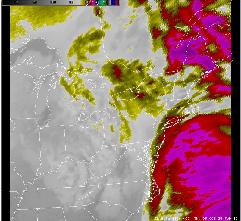
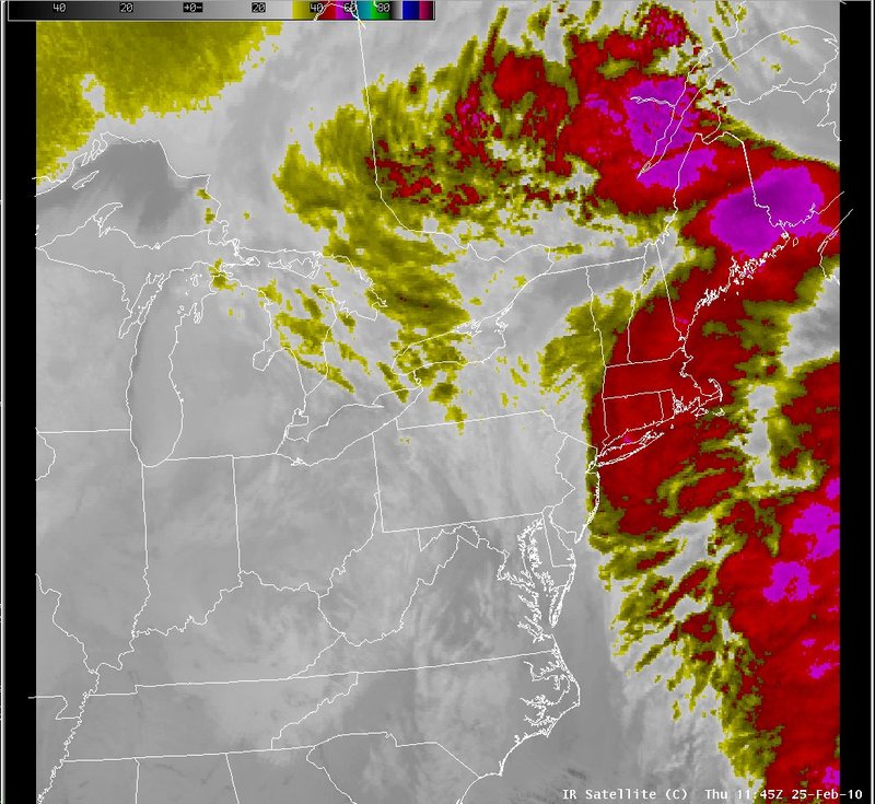
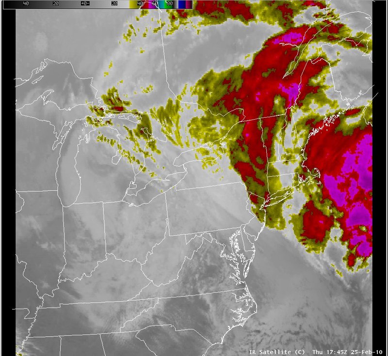
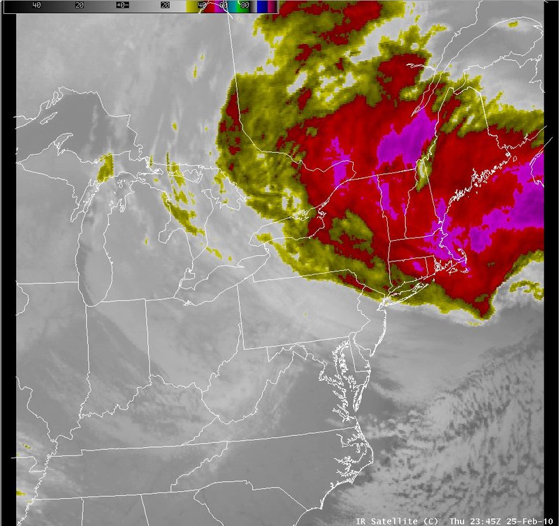
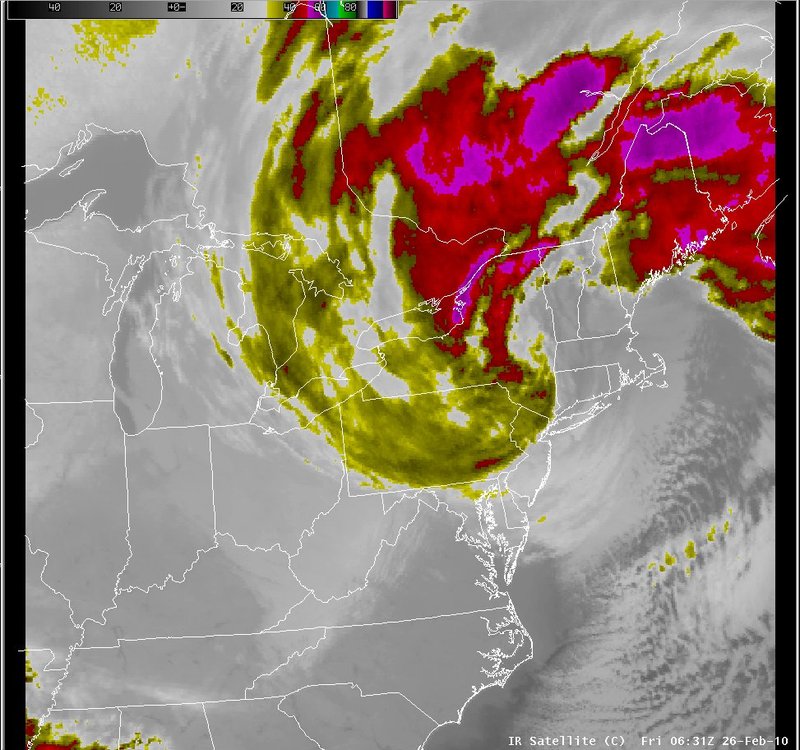
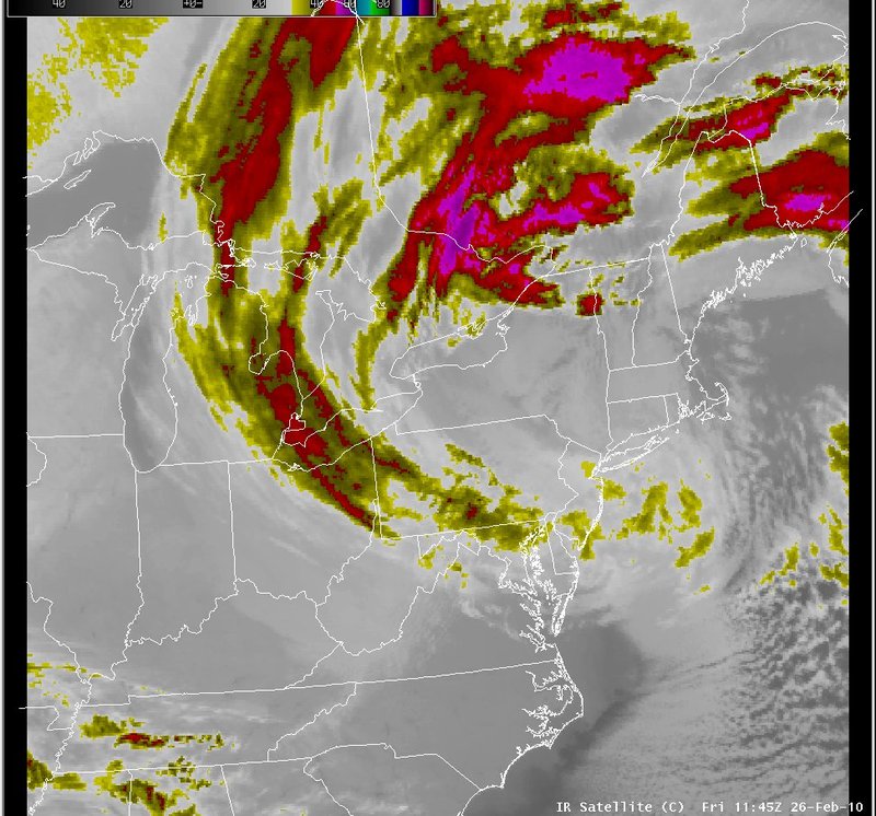
The evolution of the cloud pattern associated with this storm indicated that initially the cool cloud tops were offshore. As the storm deepened, colder clouds rotated west from the Atlantic back across New England, New York and Pennsylvania.
|
Switch images by moving your mouse pointer over the links below...
Valid Thu 0600 UTC 25-Feb-2010 Valid Thu 1145 UTC 25-Feb-2010 Valid Thu 1745 UTC 25-Feb-2010 Valid Thu 2345 UTC 25-Feb-2010 Valid Fri 0631 UTC 26-Feb-2010 Valid Fri 1145 UTC 26-Feb-2010 |
|
Slide 20