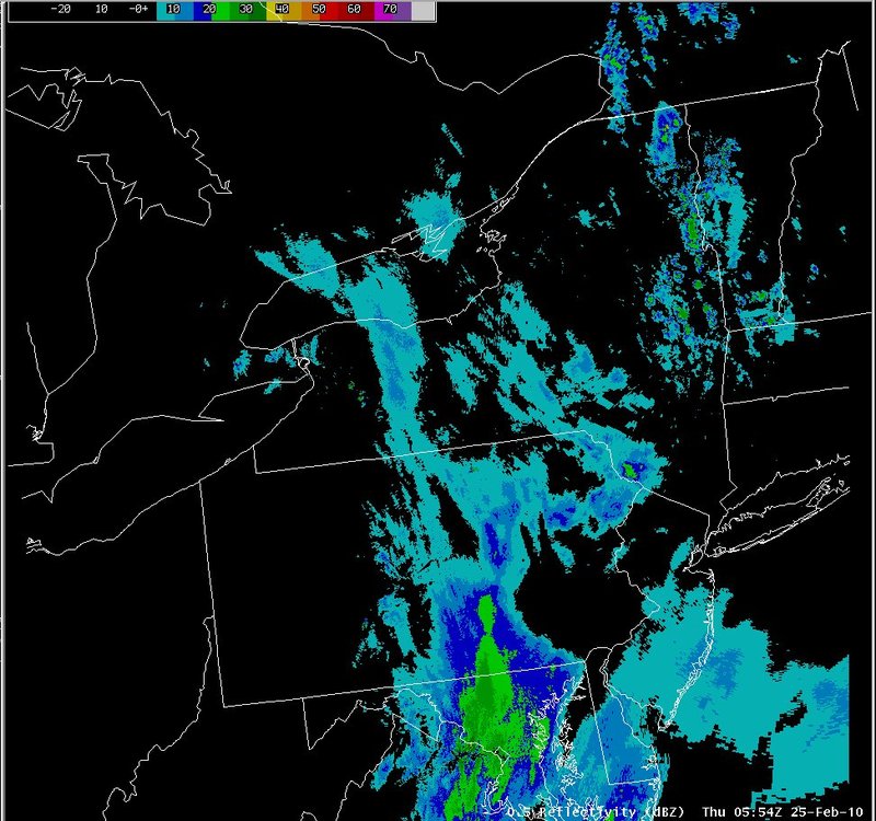
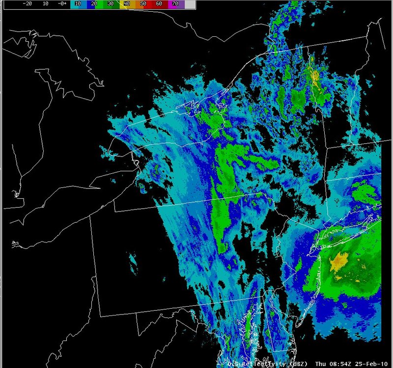
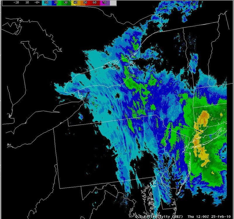
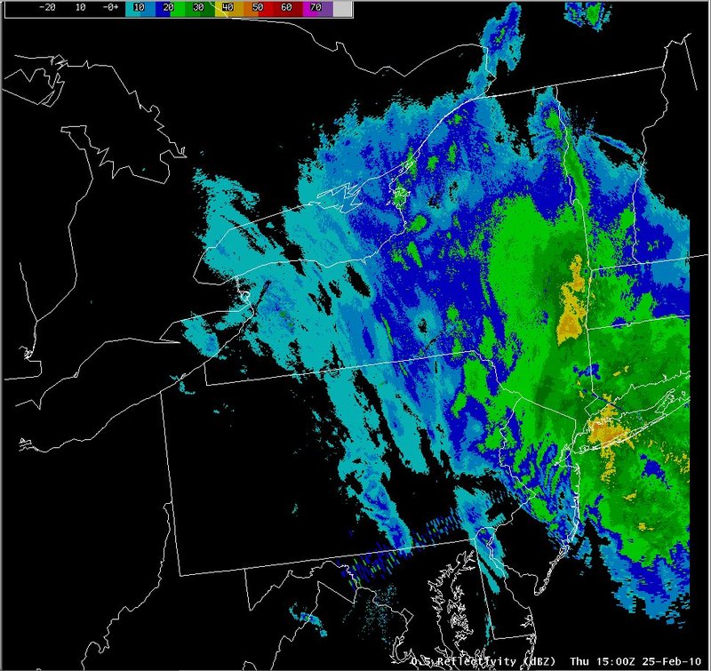
Radar reflectivity
Notes:
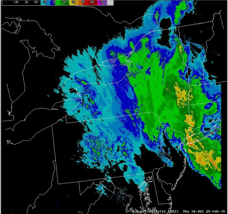
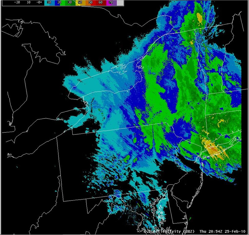
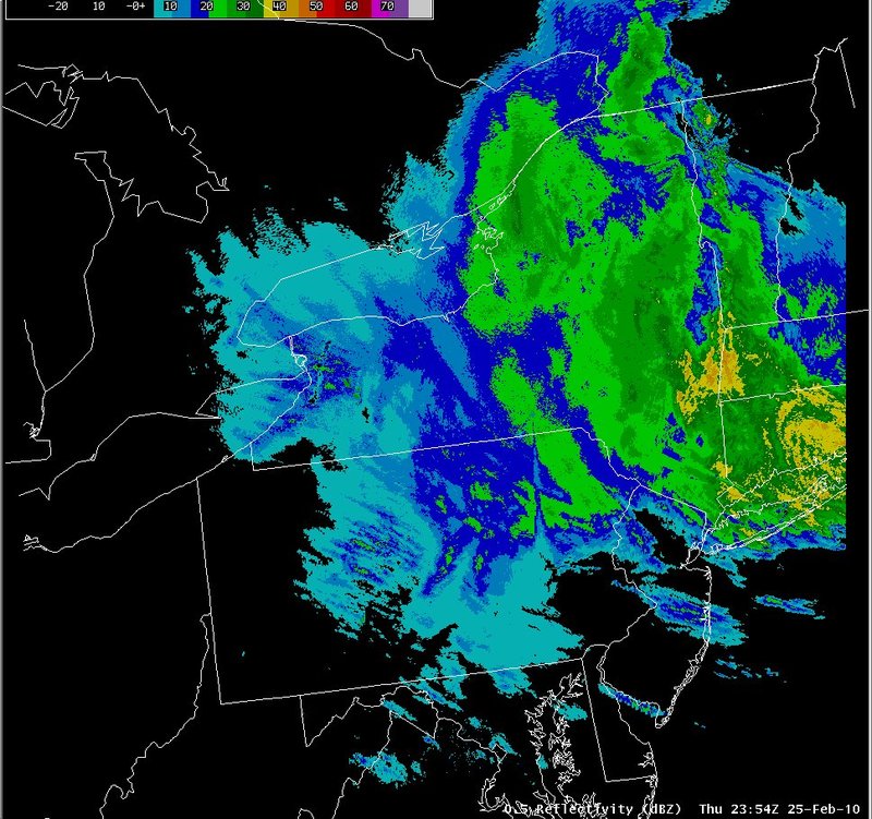
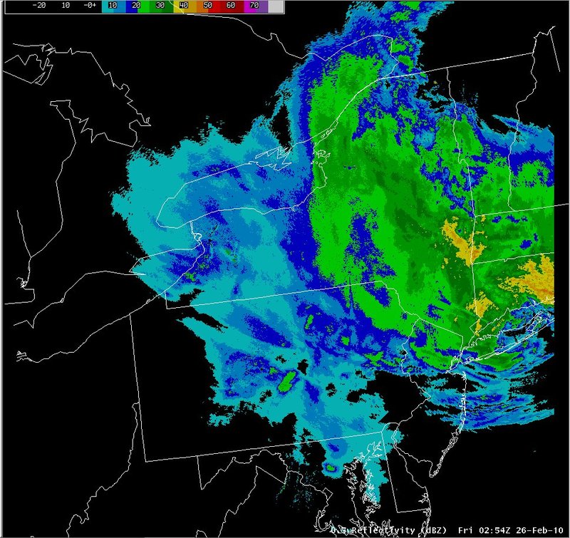
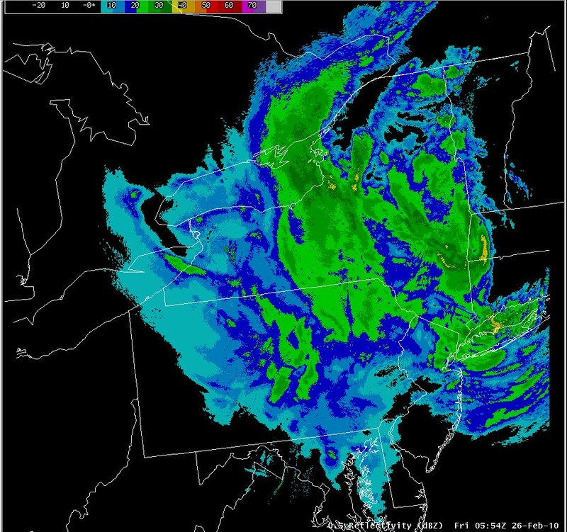
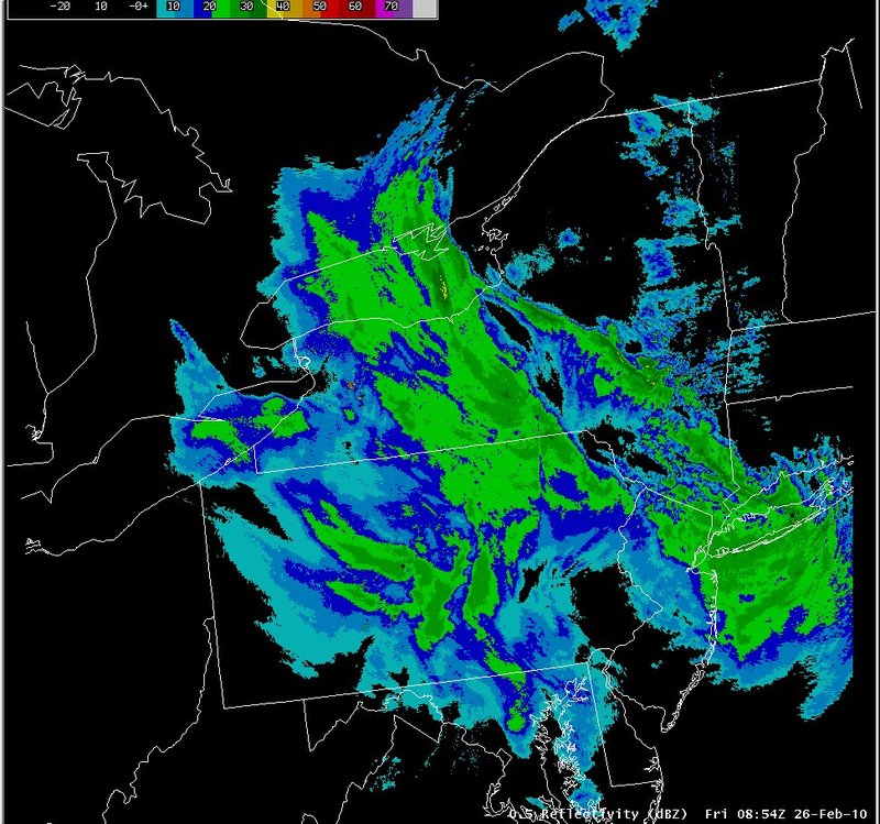
Radar loops indicated a widespread area of moderate snow developing across the area on the 25th and continuing into the 26th. Banding with this event appeared to be limited across New York and Pennsylvania until early on the 26th, when instability associated with the cold front aloft increased, resulting in more banded reflectivity structures between 06z and 12z.|
Switch images by moving your mouse pointer over the links below...
Valid Thu 0554 UTC 25-Feb-2010 Valid Thu 0854 UTC 25-Feb-2010 Valid Thu 1200 UTC 25-Feb-2010 Valid Thu 1500 UTC 25-Feb-2010 Valid Thu 1800 UTC 25-Feb-2010 Valid Thu 2054 UTC 25-Feb-2010 Valid Thu 2354 UTC 25-Feb-2010 Valid Fri 0254 UTC 26-Feb-2010 Valid Fri 0554 UTC 26-Feb-2010 Valid Fri 0854 UTC 26-Feb-2010 |
|
Slide 21