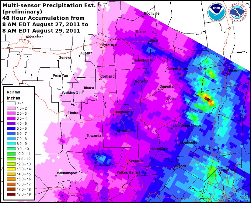
Multi-sensor 48-hour precipitation estimate for the 48 hour period ending at 12z on August 29th
Notes:
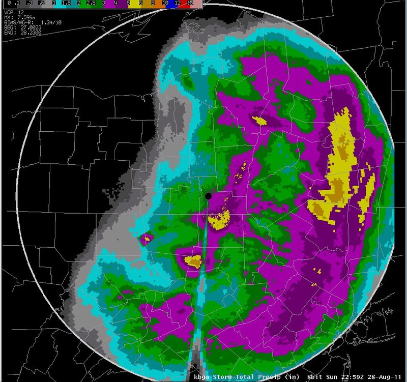
The heaviest precipitation near our area fell from the Hudson valley and eastern Catskills north toward Vermont. An isolated total of over 15 inches can be seen over the eastern Catskills. A secondary band of heavier precipitation, with amounts of 3 to 8 inches occurred from the central Mohawk valley southwest to Wyoming county, Pennsylvania, with a weak minima between the two maximas. The radar estimates were generally 1 to 2 inches lower then the MPE in the southeast. For example, the MPE in southeast Sullivan county was 6 to 8 inches, while radar estimates in that area were 4 to 5 inches. Near BGM, both sources indicated approximately 3 to 4 inches. The maxima in Wyoming county was 7 to 8 inches in the MPE data, and 6 to 7 inches in the radar estimate.
Slide 17