Radar precipitation estimate vs. MPE thru 12z, August 28
Notes:
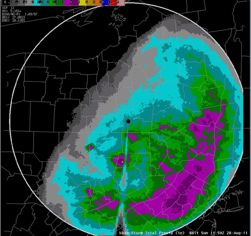
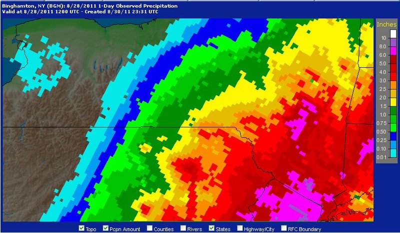
A comparison of radar estimated rainfall (top; radar was in convective Z/R through 12z, then switched to tropical Z/R) vs. MPE estimated rainfall, which includes gage data (bottom), indicated that the radar was likely underestimating rainfall over the southeast third of the forecast area through 12z. For example, the radar was indicating mostly 2 to 3 inches across the southeast through 12z, with spotty 3 to 4 inch amounts. The MPE data indicated widespread 3 to 4 inch amounts, with isolated 5 to 6 inch amounts in the far east and south. Farther northwest, the estimates appeared to be better. For example, in the area close to BGM, both sources indicated rainfall amounts around 2 inches through 12z. These results imply that the convective Z/R was likely underestimating amounts over the southeast part of the warning area through 12z, but was providing good estimates elsewhere.
Slide 16