Satellite imagery - March 7, 00z-06z
Notes:
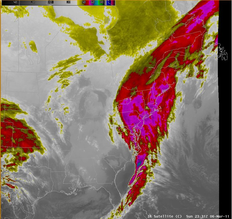
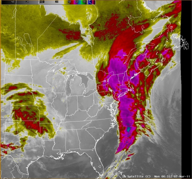
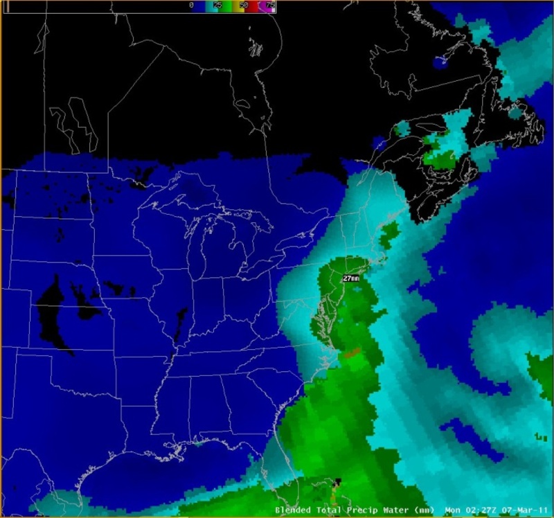
The anticyclonically curved western edge of the cloud band shown in these images from early on the 7th was a classic indicator of low-level cyclogenesis along the east coast. The blended precipitable water image continued to indicate values near to just over an inch along the east coast.
|
Switch images by moving your mouse pointer over the links below...
IR Satellite Sun 2331 UTC 06-Mar-2011 IR Satellite Mon 0631 UTC 07-Mar-2011 Blended Total Precip Water Mon 0227 UTC 07-Mar-2011 |
|
Slide 4