Radar reflectivity, ZDR, CC and the hydrometeor classification
Notes:
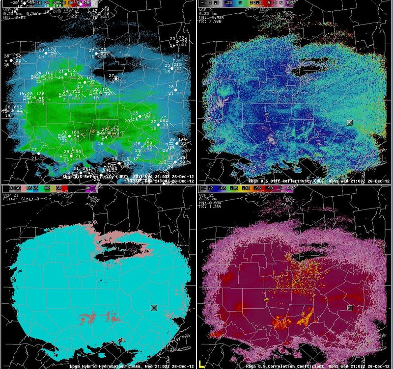
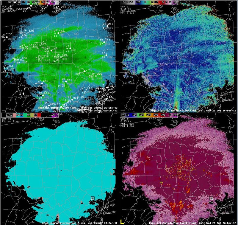
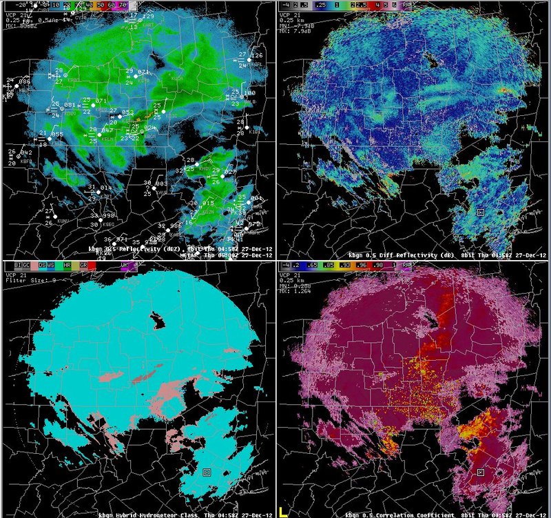
The data on this slide is a summary of radar data seen during the event. Reflectivity data (upper left) show that the event began with a large area of light to moderate snow overspreading northeast Pennsylvania and southern New York during the afternoon on the 26th. Some bands of moderate to heavy snow can be seen tracking north across the area during the early evening. These bands produced snowfall rates of 1 to 2 inches per hour, but they did not remain stationary in any one area. The dry slot, associated with spottier precipitation, can be seen moving north across the area later in the evening. ZDR values (upper right) associated with the snow generally ranged from 0.25 to 0.50. Correlation coefficient values (lower right) associated with the snow were generally greater than 0.99, and the hydrometeor classification scheme (lower left) indicated "dry snow". Higher values of ZDR, ranging from 0.75 to 1.75, were associated with some mixed precipitation over northeast Pennsylvania after 00z. Meanwhile, correlation coefficient values fell to between 0.90 to 0.98 in the mixed precipitation south of the radar.
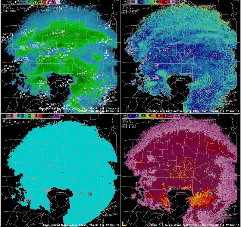
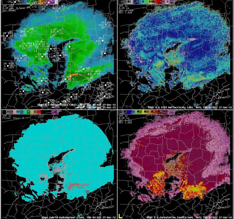
Despite base data that indicated mixed precipitation over northeast Pennsylvania, the hydrometeor classification scheme continued to indicate mostly "dry snow" across that area through 05z (lower left), with some "graupel".
Switch images by moving your mouse pointer over numbered buttons...
|
|
|
Slide 18