700 mb heights, temperature and frontogenesis
Notes:
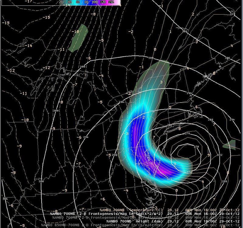
By the time that the storm was approaching the mid-Atlantic coast, it was caught up in a very baroclinic environment. As a result, a strong band of low-to-mid level frontogenesis developed east of the system. In this loop, the frontogenesis band can be seen tracking from eastern Pennsylvania westward, then weakening as the temperature gradient weakened. Heaviest precipitation fell along the band across southern Pennsylvania and southward across the mid-Atlantic region.
Switch images by moving your mouse pointer over the links below...
[1800 UTC 29-Oct-2012]
[0000 UTC 30-Oct-2012]
[0600 UTC 30-Oct-2012]
|
![[0000 UTC 30-Oct-2012]](slide9b.jpg)
![[0600 UTC 30-Oct-2012]](slide9c.jpg)
Slide 9