500 mb Heights and Vorticity, 2100 UTC, 1 June
Notes:
From SPC archives, at 2100 UTC, 1 June, analyses of 500 mb height contours (black) and vorticity isopleths (black dashed, with color fill), using short-term RUC model data. Areas of positive mid-level differential vorticity advection are outlined in blue, while negative differential vorticity advection is outlined in red. Other than a weak vorticity lobe over upstate NY, short-waves were generally not in the vicinity of PA.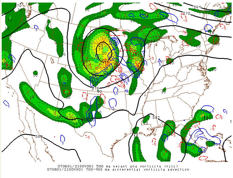
Slide 13
|
|
|||
| National Weather Service Binghamton Weather Forecast Office 32 Dawes Drive Johnson City, NY 13790 (607) 729-1597 Page last modified: June 26, 2007. |
|||