Radar Loop for June 1st (18z – 23z); every 30 minutes
Watch the back-building storm cluster over Northeast PA
Notes:
Animated radar imagery between 1800 and 2300 UTC, 1 June. This loop well depicts the nearly stationary cluster of thunderstorms that produced flash flooding in the Pocono Mountain region. To actually see the images loop, click the slide show tab (lower left part of the screen). Hitting the escape key gets the speaker notes back.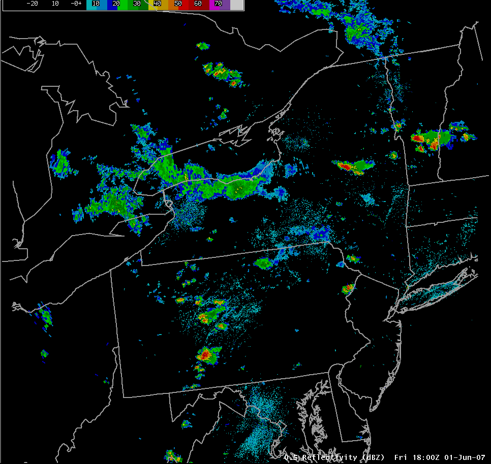
Slide 18
|
|
|||
| National Weather Service Binghamton Weather Forecast Office 32 Dawes Drive Johnson City, NY 13790 (607) 729-1597 Page last modified: June 26, 2007. |
|||