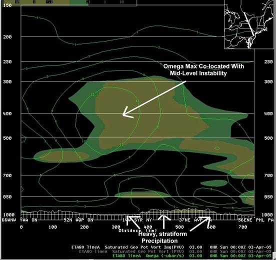
Omega and negative EPV 03/00 UTC.
| Created with the Web Accessibility Wizard |
|
Omega and negative EPV 03/00 UTC. |
|
|
Slide Links:
Speaker Notes:
The data on the next few slides show how some atmospheric parameters evolved as the event transitioned from a heavy stratiform rain event, to a more convective event. The data on this cross-section (taken from New Jersey to eastern Ontario) shows a maximum of mid-level omega, co-located with a large area of negative EPV. The mid-level omega is associated with strong mid-level frontogenesis (not shown). Heavy, stratiform precipitation was falling in the area where the mid-level omega maxima was co-located with mid-level instability (northeast Pennsylvania and southern New York). This is a classic signature for the development of heavy bands of precipitation within a stratiform precipitation region.