First page Back Continue Last page Research
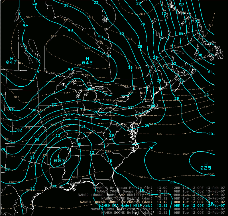
Sea-level pressure and 1000-500 thickness (From the Feb 13, 12 UTC NAM)
Notes:
At the surface, this was a classic Miller type-B storm evolution. A primary surface low tracked northeast to the Ohio Valley, with a secondary storm forming along the southeast coast. The secondary storm deepened rapidly and tracked toward southern New England.