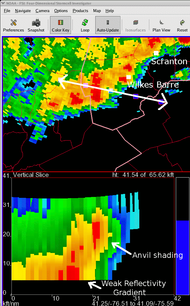
Northeast Pa convective line – 2040 UTC
Notes:
The down-shear tilt of the convection on this day is evident from the data shown on this slide. The lower image is a cross-sectiontaken from west to east through the convective line as it moved east through northeast Pennsylvania at 2040 UTC.
Note the weak reflectivity gradient at the lead edge of the storm, and the down-shear lean to the storm, resulting in considerable overhang.
This type of configuration would lead to several minutes of light rain at locations prior to the arrival of the strongest core of precipitation.
Slide 22