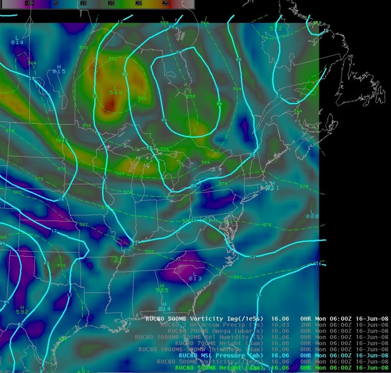
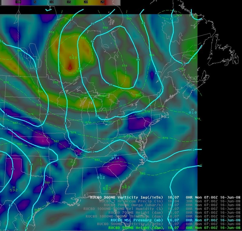
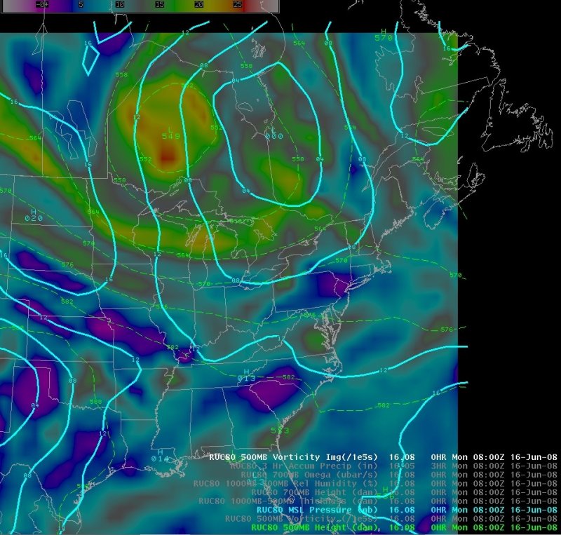
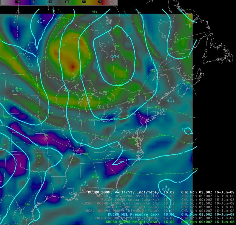
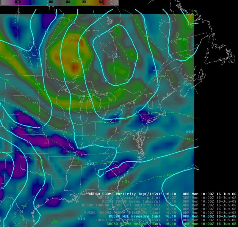
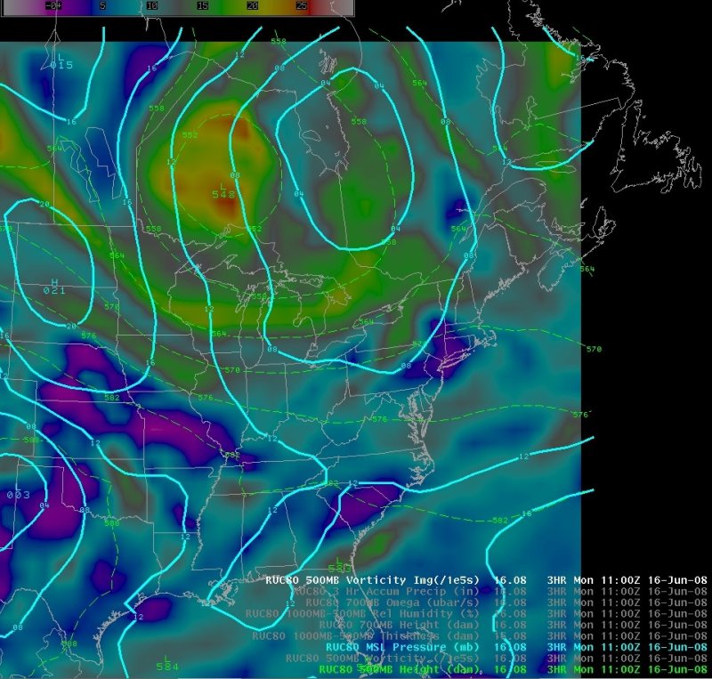
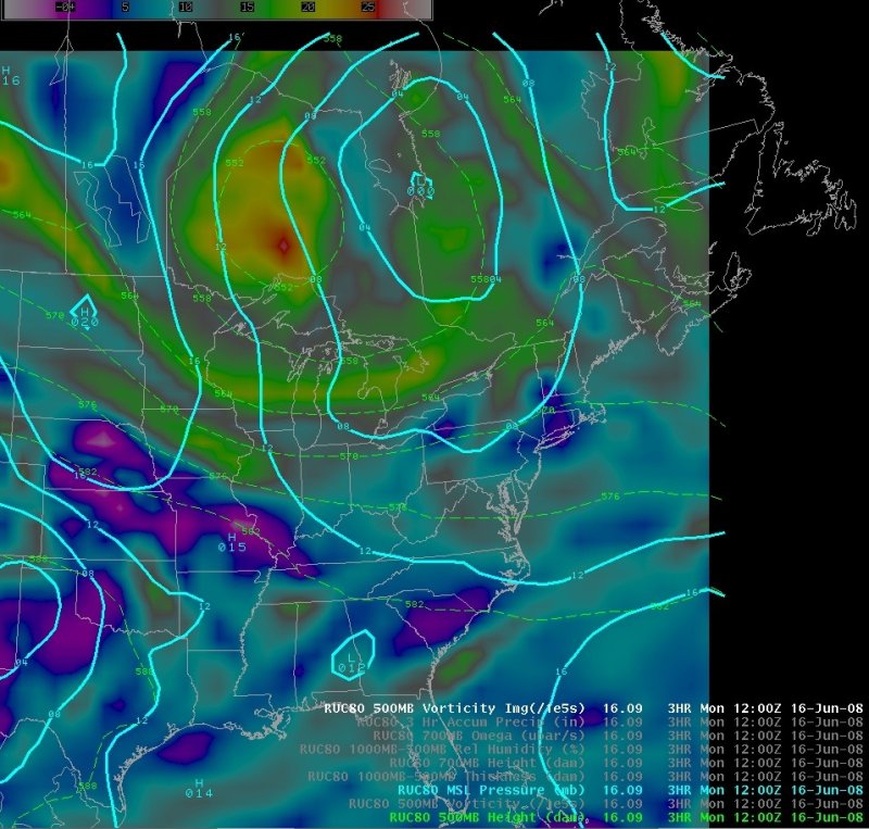
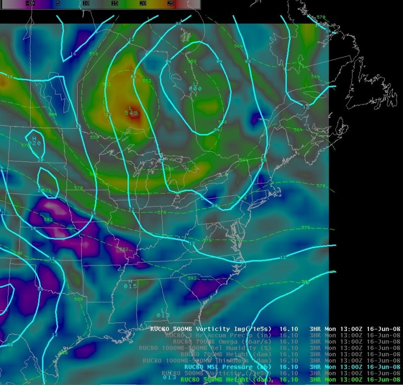
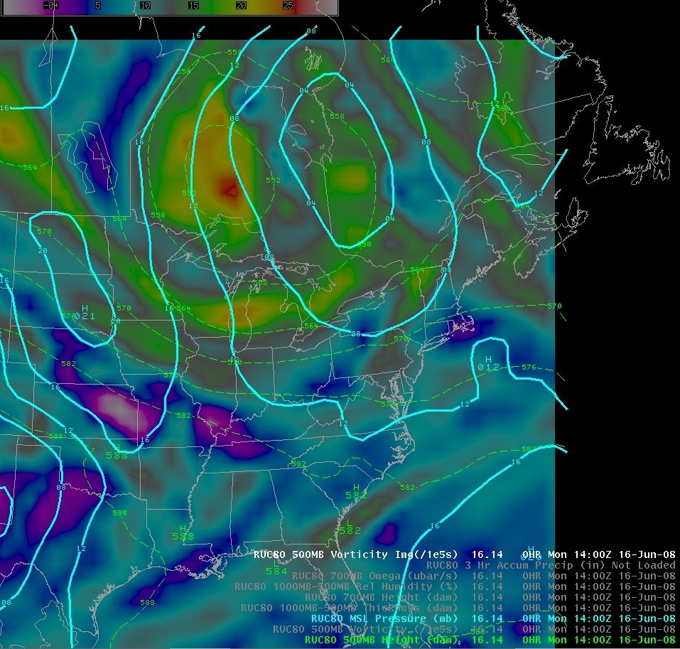
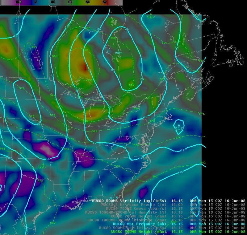
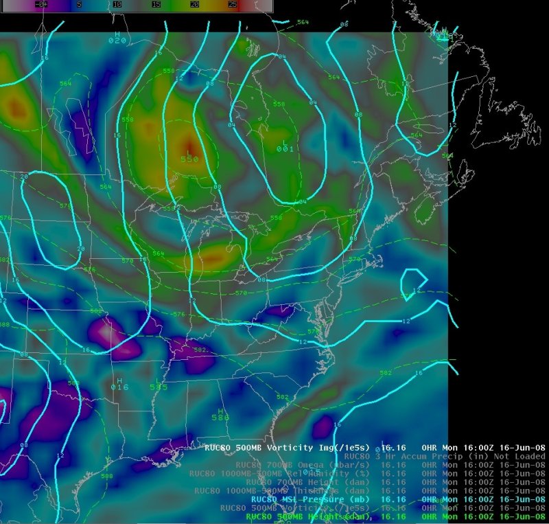
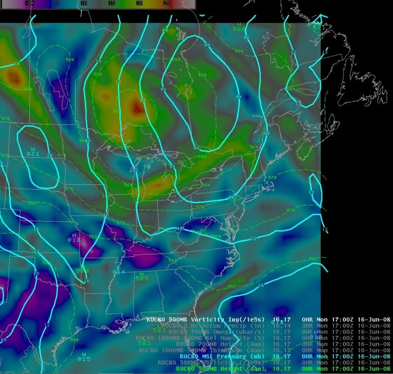
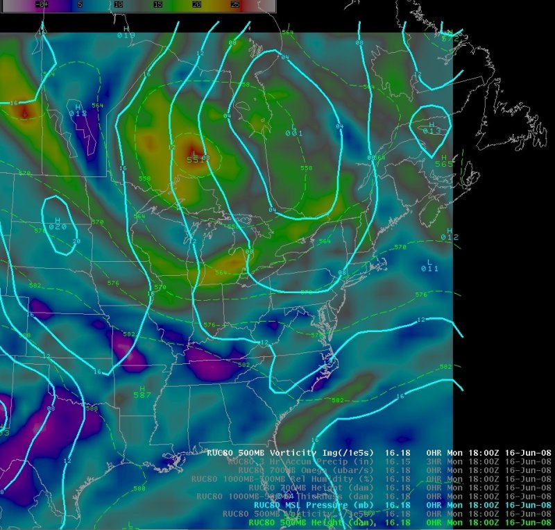
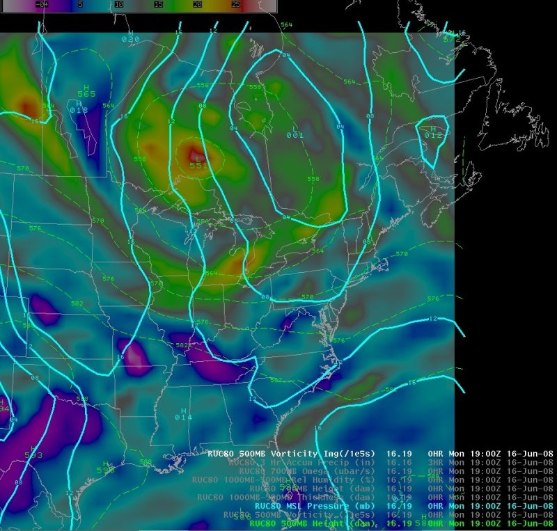
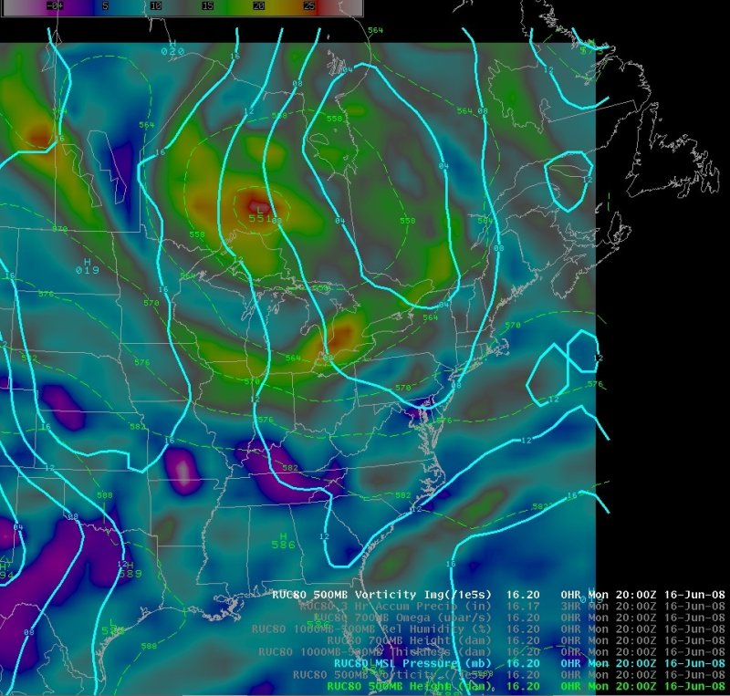
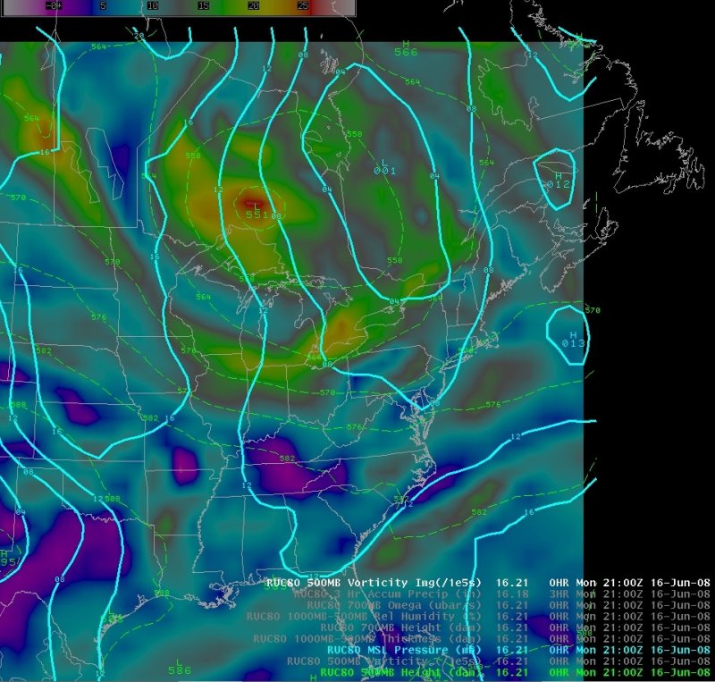
500 Height/Voricity, MSLP
Notes:An unseasonably strong 500 mb trough was moving east across the northern Great Lakes during the day on the 16th. A wave of low pressure east of this trough moved well north of the BGM CWA with its attendant cold front and pre frontal trough impacting the area. |
Slide 4