RUC low-level sounding - 12/1 11z
Notes:
Strong low-level winds were forecast on model soundings for this event. The data on this slide shows the lowest 4000 feet of a 2 hour RUC forecast at Binghamton, valid at 11 UTC on the 1st. The strongest winds at the airport were observed around this time, with a peak wind gust of 40 kts. The maximum wind below 2000 feet on the forecast sounding was 54 kts, and the maximum wind below 850 mb was 71 kts. Southeast winds are often associated with large stability, keeping strong winds from reaching the surface. In this case however, the low-level stability indicated on the sounding was not particularly large. The annotations on the slide show that the surface to 1000 foot lapse rate was 1.5 degrees C, and the surface to 2000 foot lapse rate was 1.9 degrees C. This slight decrease in temperature with height indicated that there would be potential for some strong winds to mix to the surface.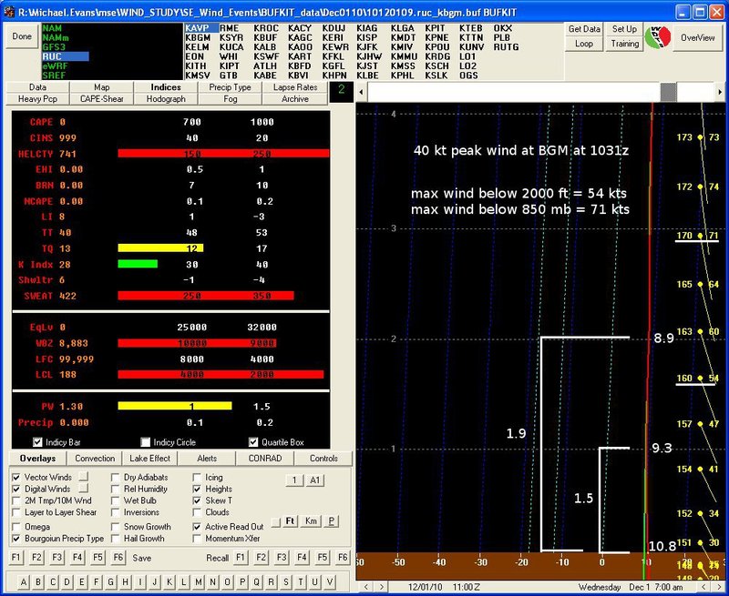
Slide 10