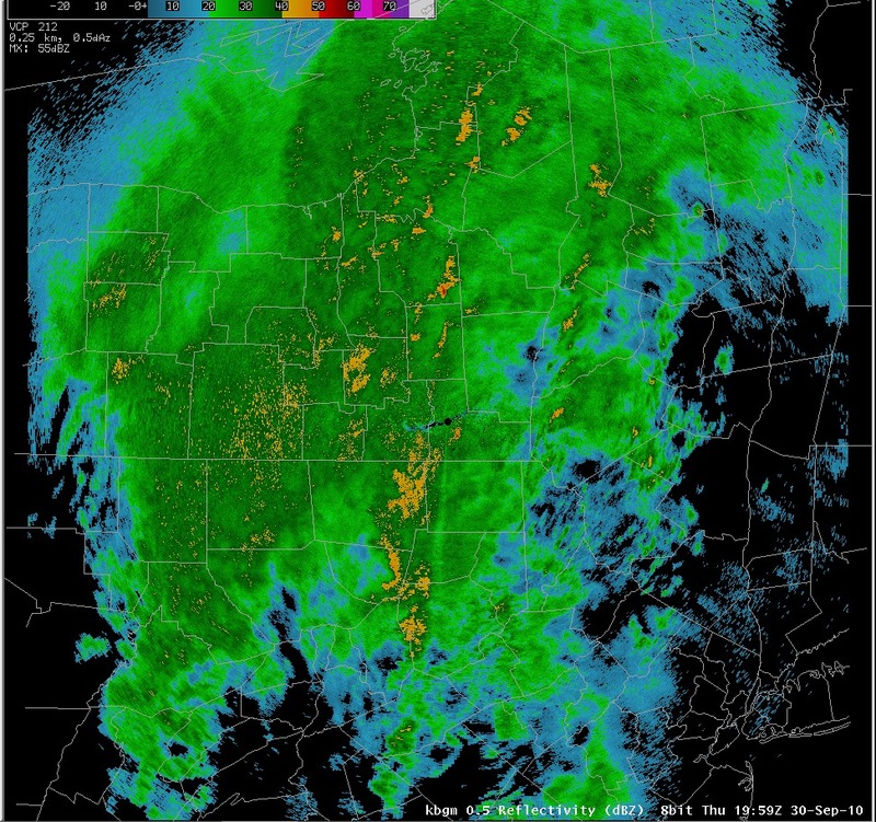
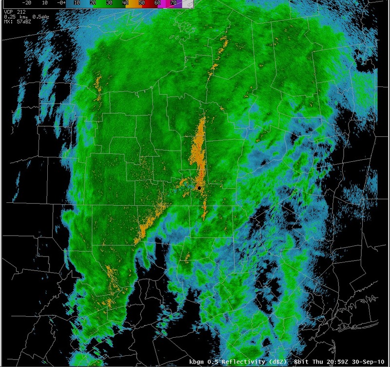
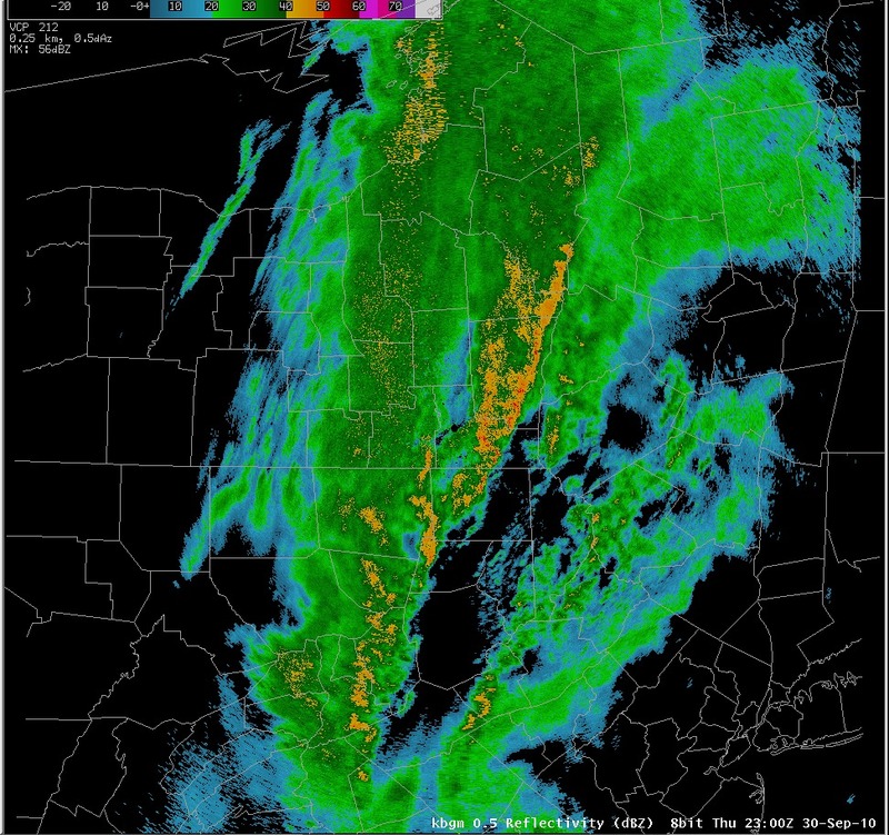
Radar reflectivity - 20z through 23z, September 30, 2010
Notes:
This series of radar images shows widespread moderate to heavy rain across northeast Pennsylvania and central New York during the afternoon on the 30th. Bands of heavy rain can be seen developing after 20z. These bands of heavier rain were associated with bursts of 1 inch per hour rainfall, which resulted in flooding over western Broome county and eastern Tioga county, along with much of Cortland county.|
Switch images by moving your mouse pointer over the links below...
Valid 1959 UTC 30-Sep-2010 Valid 2059 UTC 30-Sep-2010 Valid 2159 UTC 30-Sep-2010 Valid 2300 UTC 30-Sep-2010 |
|
Slide 14
|
|
|||
| National Weather Service Binghamton Weather Forecast Office 32 Dawes Drive Johnson City, NY 13790 (607) 729-1597 Page last modified: September 07, 2010. |
|||