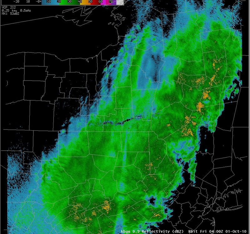
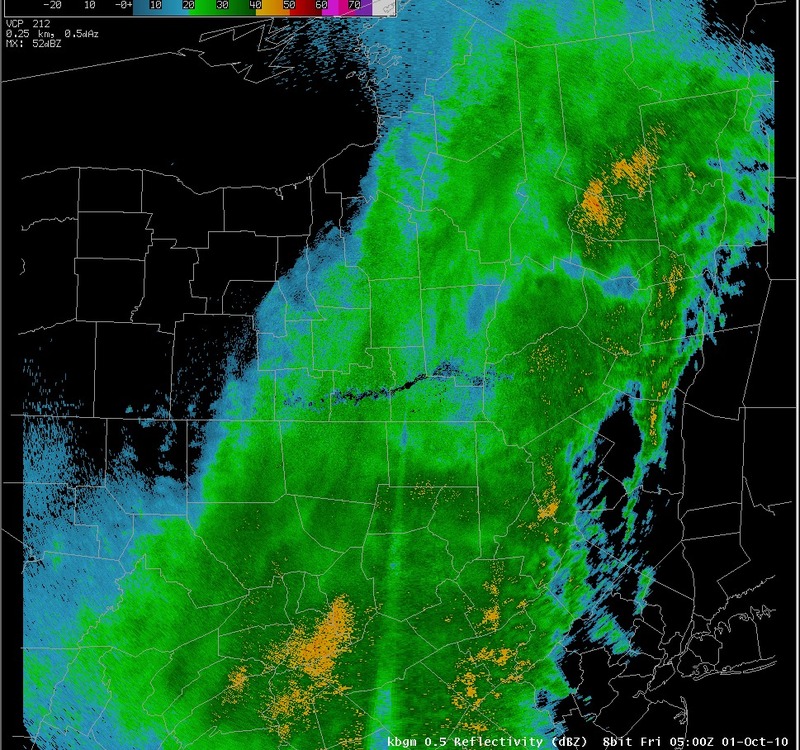
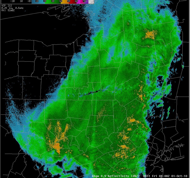
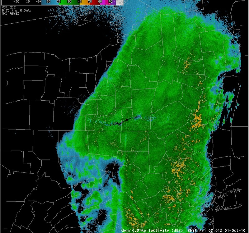
Radar reflectivity - 03z to 07z, October 01, 2010
Notes:
The radar images on this slide shows moderate to heavy rain continuing through much of the night across the area, with bands of heavier rain training from northeast Pennsylvania to the Catskill mountains of east central New York.

|
Switch images by moving your mouse pointer over the links below...
Valid 0300 UTC 01-Oct-2010 Valid 0400 UTC 01-Oct-2010 Valid 0500 UTC 01-Oct-2010 Valid 0600 UTC 01-Oct-2010 Valid 0701 UTC 01-Oct-2010 |

|
Slide 15
|
|
|||
| National Weather Service Binghamton Weather Forecast Office 32 Dawes Drive Johnson City, NY 13790 (607) 729-1597 Page last modified: September 07, 2010. |
|||