Radar Loop
Notes:
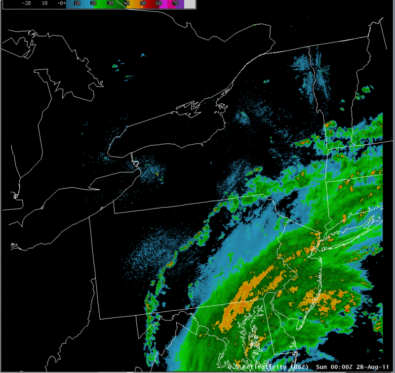
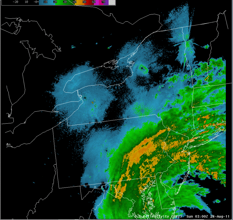
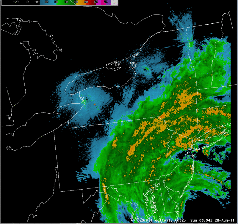
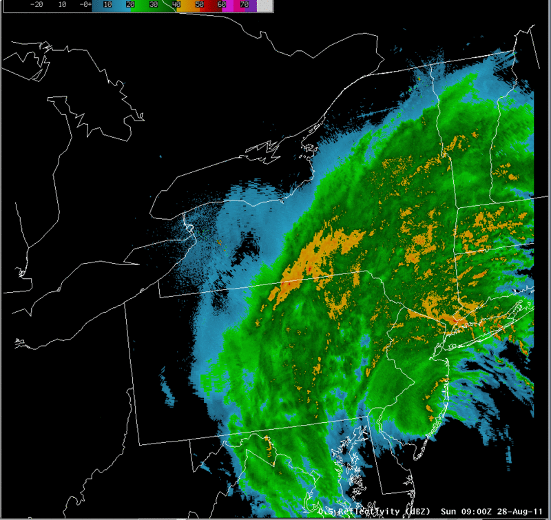
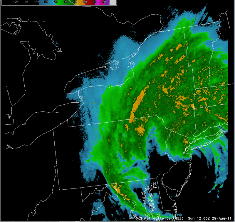
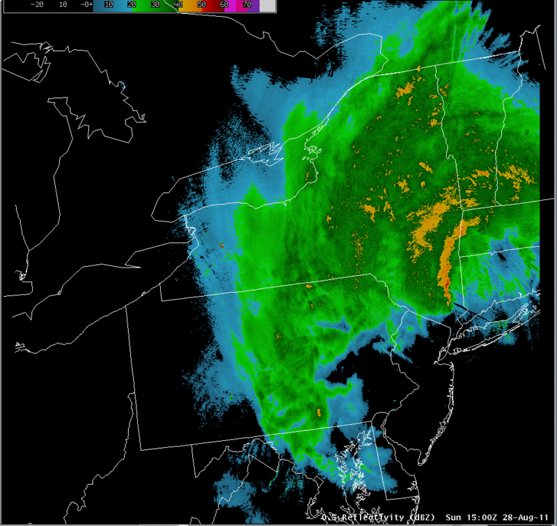
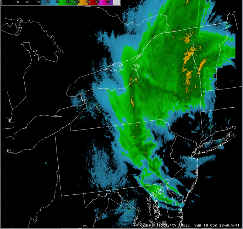
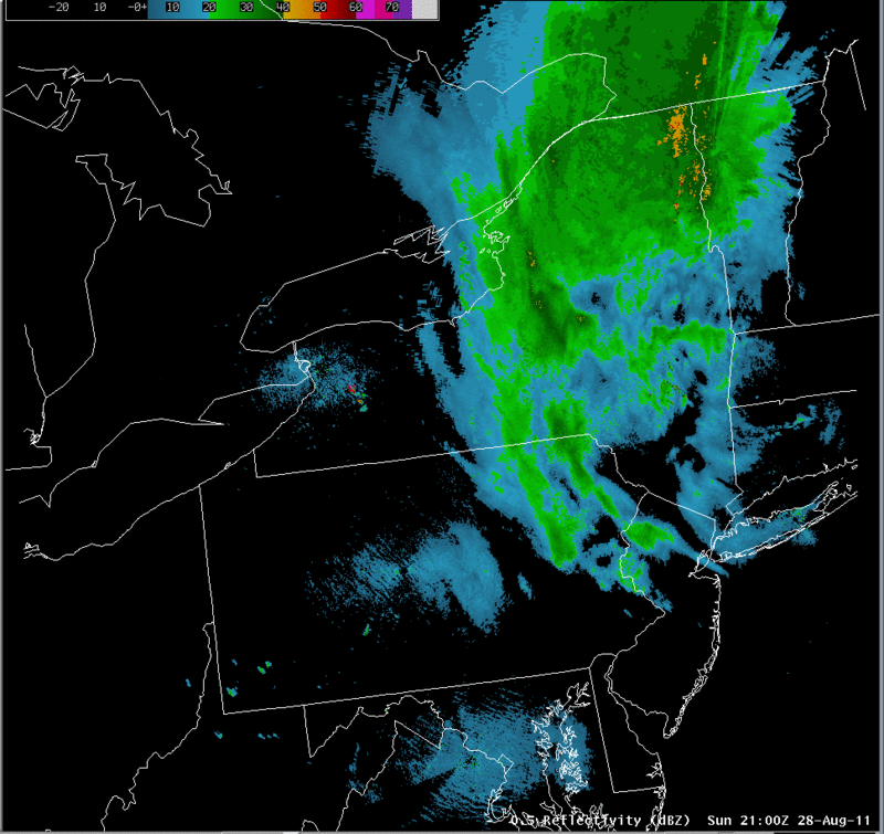
The radar loop for the event shows a large shield of heavy precipitation moving northward with Irene. Eventually, a significant band of heavy precipitation develops on the west side of the storm, associated with the strong frontogenesis that developed in that area.
|
Switch images by moving your mouse pointer over the links below...
Valid Sun 0000 UTC 28-Aug-2011 Valid Sun 0300 UTC 28-Aug-2011 Valid Sun 0554 UTC 28-Aug-2011 Valid Sun 0900 UTC 28-Aug-2011 Valid Sun 1200 UTC 28-Aug-2011 Valid Sun 1500 UTC 28-Aug-2011 Valid Sun 1800 UTC 28-Aug-2011 Valid Sun 2100 UTC 28-Aug-2011 |
|
Slide 15